Search Results
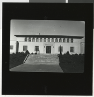
Photograph of the Bureau of Reclamation Building, Boulder City (Nev.), 1934
Date
1934-01
Archival Collection
Description
Photograph taken by John McCreary of the Bureau of Reclamation Building in Boulder City, Nev., January 1934.
Image
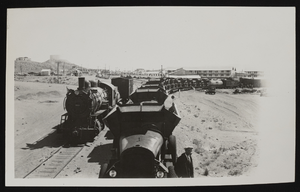
Photograph of trains, Boulder City (Nev.), approximately 1931-1936
Date
1931 to 1936
Archival Collection
Description
A train passing Boulder City, Nevada near the workers' dormitories. Site Name: Hoover Dam (dam)
Image
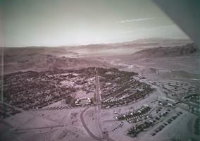
Film transparency of Boulder City, Nevada, and Lake Mead, circa 1931-1936
Date
1931 to 1936
Archival Collection
Description
An image showing an aerial view of Boulder City. The outlines of the small city are distinctively marked by the stark contrast between the city's greenery and the surrounding desert. In the far distance, the shores of Lake Mead can be seen peaking out from behind the mountains. Note: Bits of the airplane from which the image itself was taken can be seen in the upper right corner of the photograph.
Image

Film transparency of a welcoming banner, Boulder City, Nevada, circa 1931-1936
Date
1931 to 1936
Archival Collection
Description
An image of a car traveling down an unidentified street in Boulder City. Small houses line the left side of the street, as a Mobil gas station sits on the right side of the street. The banner hanging above the road reads: "Welcome to Boulder City."
Image
Mormon Influence in Boulder City: research, 2017
Level of Description
File
Archival Collection
Dennis McBride Personal Papers
To request this item in person:
Collection Number: MS-01099
Collection Name: Dennis McBride Personal Papers
Box/Folder: Box 26 (Restrictions apply)
Collection Name: Dennis McBride Personal Papers
Box/Folder: Box 26 (Restrictions apply)
Archival Component
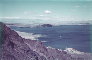
Slide of Lake Mead, outside of Boulder City, circa 1930s
Date
1936 to 1940
Archival Collection
Description
A color slide of Lake Mead outside of Boulder City, Nevada.
Image
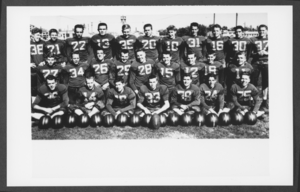
Photograph of Boulder City High School football team, 1947
Date
1947
Archival Collection
Description
A group photograph of the Boulder City High School football team.
Image
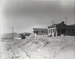
Photograph of construction in Boulder City, Nevada, October 12, 1931
Date
1931-10-12
Archival Collection
Description
The grayscale view of government engineers' home under construction in Boulder City, Nevada.
Image
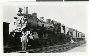
Photograph of a locomotive and driver, Boulder City, May 31, 1931
Date
1931-05-31
Archival Collection
Description
Black and white photograph of the locomotive Boulder City Special and driver Oscar Peiffer.
Image