Search Results
Aerial photograph of Las Vegas looking west, 1945
Date
Archival Collection
Description
Aerial view of Las Vegas immediately following the close of World War II
Image

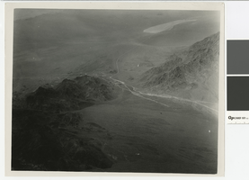
Aerial photograph of the Colorado River, Hemenway Wash, and the site of Boulder City, before 1930
Date
Archival Collection
Description
Aerial view of the Colorado River, Hemenway Wash, and the site of Boulder City
Image
Aerial photograph of Railroad Pass, Nevada, before 1930
Date
Archival Collection
Description
Aerial view of Railroad Pass looking south, U.S 93 and U.S. 95 can be seen as dirt roads.
Transcribed Notes: Stamped on back of photo: Glenn A. Davis Photographer
Image

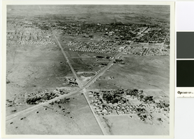
Aerial photograph of Las Vegas and surrounding valley, circa 1920
Date
Archival Collection
Description
Aerial view of Las Vegas looking west.
Transcribed Notes: Stamped on back of photo: Glenn A. Davis Photographer
Image
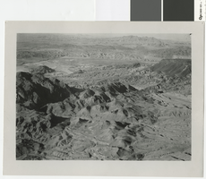
Aerial photograph of the Colorado River between Fortification Hill and Hemenway Wash, before 1930
Date
Archival Collection
Description
Aerial view of the Colorado River looking north between Fortification Hill and Hemenway Wash.
Image
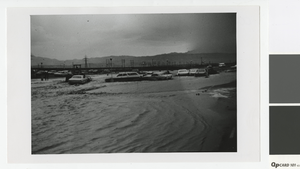
Photograph of flooding in the Las Vegas Valley, circa 1970
Date
Archival Collection
Description
Flooding in Las Vegas
Image
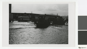
Photograph of flooding on the Las Vegas Strip, circa 1970
Date
Archival Collection
Description
Flooding on the Las Vegas Strip, Dunes Hotel and Country Club in the background
Image
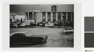
Photograph of flooding in a Las Vegas parking lot, circa 1970
Date
Archival Collection
Description
Flooding in a Las Vegas parking lot
Image

Aerial photograph of Las Vegas, 1915
Date
Archival Collection
Description
Aerial view of Las Vegas in 1915.
Image

Aerial photograph of downtown Las Vegas, circa 1970
Date
Archival Collection
Description
Aerial view of downtown Las Vegas, looking northwest. The Union Plaza can be seen in lower left hand corner.
Image