Search Results


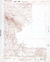
Map of Ely Range Quadrangle, Lincoln County, Nevada, 1921
Date
Description
Image
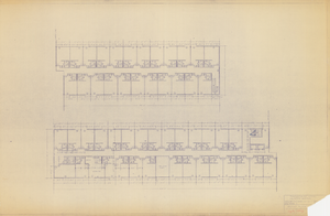
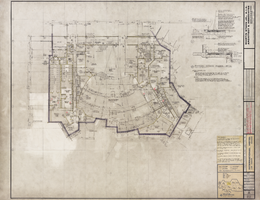
Architectural drawing of Thunderbird Hotel (Las Vegas), 214 room addition, second floor plan, October 10, 1962
Date
Archival Collection
Description
Architectural plans for the addition of the Aztec Building to the Thunderbird Hotel. "Aztec Bldg." handwritten in red pencil in lower right corner.
Site Name: Thunderbird Hotel
Address: 2755 Las Vegas Boulevard South
Image
Architectural drawing of the International Hotel (Las Vegas), first floor plan section D, August 5, 1968
Date
Archival Collection
Description
Architectural plans for the International Hotel, Las Vegas, Nevada from 1968. Printed on mylar. Includes revisions, floor plan notes, and sanding and finishing notes. Berton Charles Severson, architect; Brian Walter Webb, architect; G. I. Zaima, delineator.
Site Name: International Hotel
Address: 3000 Paradise Road
Image
Letter from A. M. Folger (Las Vegas) to Frank Strong, June 18, 1948
Date
Archival Collection
Description
Folger would like Strong to grant permission to allow the City of Las Vegas to relocate a small portion of the Las Vegas Creek.
Text
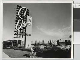
Photograph of a woman drawing in front of the Sands Hotel (Las Vegas), mid-1950s
Date
Archival Collection
Description
View of the front of the Sands, including its sign and front parking area, in the mid-1950s. Stamped on original: "Please credit Union Pacific Railroad Photo, Public Relations Department, 422 West 6th St., Los Angeles 14, Calif, File Print Stock, Los Angeles Neg."
Site Name: Sands Hotel
Address: 3355 Las Vegas Boulevard South
Image