Search Results
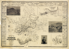
Map of the Tonopah Mining District, Nye County (Nev.), 1902
Date
1902
Description
Map of the Tonopah Mining District, Nye County (Nev.), 1902
Image
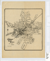
Map of the Tonopah Mining District, Nye County (Nev.), 1903
Date
1903
Description
Scale [ca. 1:7,200]. 1 in. equals 600 feet ; 1 map ; 17 x 16 cm ; Relief shown by hachures ; Library's copy has some mines cross-hatched in pencil ;
Image
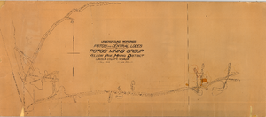
Map of the underground workings in Potosi and Central Lodes of Potosi Mining Group, Lincoln County (Nev.), May, 1906
Date
1906-05
Description
Map of the underground workings in Potosi and Central Lodes of Potosi Mining Group, Lincoln County (Nev.), May, 1906
Image
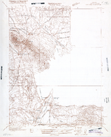
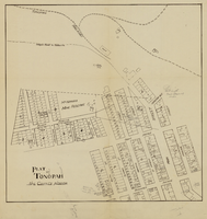
Map of Nevada, Lincoln County, Ely Range Quadrangle, Lincoln County (Nev.), 1921
Date
1921
Description
Map of Nevada, Lincoln County, Ely Range Quadrangle, Lincoln County (Nev.), 1921
Image
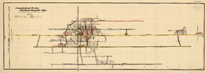
Map of the Longitudinal Section, Montana Tonopah Mine, Nye County (Nev.), 1900-1925
Date
1900 to 1925
Description
Map of the Longitudinal Section, Montana Tonopah Mine, Nye County (Nev.), 1900-1925
Image
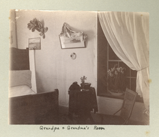
Photograph of a bedroom in the Mills family home, Eldorado Canyon (Nev.), 1900-1925
Date
1900 to 1925
Description
Caption: Grandpa and Grandma's Room
Image
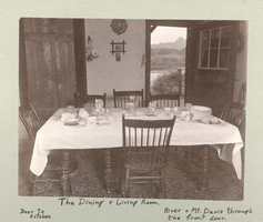
Photograph of the dining and living rooms of the Mills family home, Eldorado Canyon (Nev.), 1900-1925
Date
1900 to 1925
Description
Caption: l-r Door to Kitchen; The Dining and Living Room. River and Mt. Davis through the front door.
Image