Search the Special Collections and Archives Portal
Search Results
Oral history project: Donna Andress, 2007-2016
Level of Description
File
Archival Collection
Junior League of Las Vegas' Records on the Morelli House Preservation Project
Archival Component
Oral history project: Virginia Richardson, 2007-2016
Level of Description
File
Archival Collection
Junior League of Las Vegas' Records on the Morelli House Preservation Project
Archival Component
Oral history project: Alice Waite, 2007-2016
Level of Description
File
Archival Collection
Junior League of Las Vegas' Records on the Morelli House Preservation Project
Archival Component

Photograph of Chabad of Las Vegas, Las Vegas (Nev.), September 22, 2016
Date
2016-09-22
Archival Collection
Description
The Chabad of Las Vegas at 1261 Arville Street.
Image
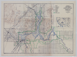
Topographic map of Boulder Canyon Project, Boulder Dam area, 1940
Date
1940
Description
Scale [ca. 1:221,760. 1 in. to approx. 3.5 miles] ; 1 map : col. ; 51 x 71 cm ; Relief shown by contours and spot heights ; Includes township and range grid ; "Map no. 40-40" ; Includes index map ; Shows power lines, triangulation stations, boundary monuments, roads, telephone lines, mines, bench marks, etc. ; U.S. Dept. of the Interior, Bureau of Reclamation
Image
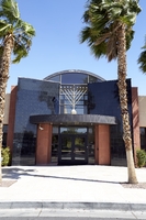
Photograph of Chabad of Las Vegas, Las Vegas (Nev.), September 22, 2016
Date
2016-09-22
Archival Collection
Description
The Chabad of Las Vegas at 1261 Arville Street.
Image
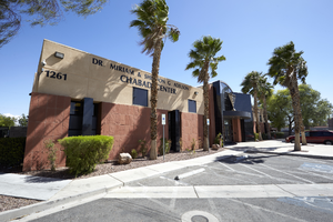
Photograph of Chabad of Las Vegas, Las Vegas (Nev.), September 22, 2016
Date
2016-09-22
Archival Collection
Description
The Chabad of Las Vegas at 1261 Arville Street.
Image
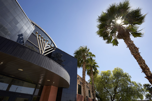
Photograph of Chabad of Las Vegas, Las Vegas (Nev.), September 22, 2016
Date
2016-09-22
Archival Collection
Description
The Chabad of Las Vegas at 1261 Arville Street.
Image
Veterans History Project interview with Stanley Spierer, undated
Level of Description
Item
Archival Collection
Shelley Berkley Papers
Archival Component
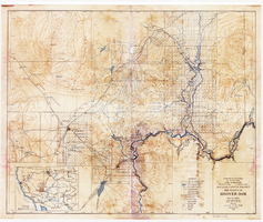
Topographic map of Boulder Canyon Project, Hoover Dam area, 1932
Date
1932
Description
Scale [ca. 1:221,760. 1 in. to approx. 3.5 miles] ; 1 map : col. ; 51 x 62 cm ; Relief shown by contours and spot heights ; "Prepared in Washington Office from compilation made in Las Vegas Office." ; "Map no. 24000." ; Includes township and range grid ; Shows power lines, triangulation stations, boundary monuments, roads, telephone lines, mines, bench marks, etc. ; Department of the Interior, Bureau of Reclamation.
Image
Pagination
Refine my results
Content Type
Creator or Contributor
Subject
Archival Collection
Digital Project
Resource Type
Year
Material Type
Place
Language
Records Classification
