Search Results

UNLV supporter, former Regent and Silver State Award winner Carolyn Sparks poses September 12, 2014 at the University of Nevada, Las Vegas: digital photographs
Date
Archival Collection
Description
Image
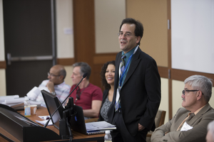
UNLV's Boyd School of Law host the Society of American Law Teachers (SALT) conference October 10, 2014 at the University of Nevada, Las Vegas: digital photographs
Date
Archival Collection
Description
Image
UNLV's Boyd School of Law host the Society of American Law Teachers (SALT) conference October 9, 2014 at the University of Nevada, Las Vegas: digital photographs
Date
Archival Collection
Description
Image
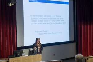
UNLV'S Brookings Mountain West hosts at a talk with Elizabeth "Beth" Akers in Greenspun Hall November 6, 2013 at the University of Nevada, Las Vegas: digital photographs
Date
Archival Collection
Description
Image
UNLV College Alumni of the Year Awards held in the Tam Alumni building during Homecoming November 1, 2013 at the University of Nevada, Las Vegas: digital photographs
Date
Archival Collection
Description
Image
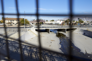
Civic Center Drive bridge crosses Las Vegas Wash as seen looking northwest through security screening on a pedestrian bridge in North Las Vegas, Nevada: digital photograph
Date
Archival Collection
Description
From the UNLV University Libraries Photographs of the Development of the Las Vegas Valley, Nevada (PH-00394). Part of the collection documents the entire 19 mile length of the north/south Eastern Avenue / Civic Center Drive alignment. This photograph was captured in the section of Civic Center Drive between Alexander Road and Cheyenne Avenue.
Image
Slide of Oldenburg's sculpture of a flashlight, University of Nevada, Las Vegas, 1981
Date
Archival Collection
Description
Image
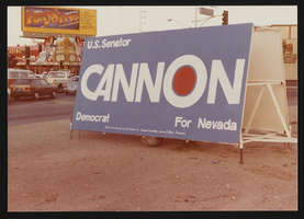
Cannon for Nevada campaign sign in Las Vegas, Nevada: photographic print
Date
Archival Collection
Description
Image
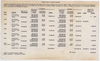
Chart, revised charges to the Las Vegas Land and Water Company, September 22, 1942
Date
Archival Collection
Description
Chart showing revised charges to the Las Vegas Land and Water Company from the Union Pacific Railroad Company for the years 1939-1941 and the first nine months of 1942 based on projected and actual water consumption in Las Vegas.
Transcribed Notes: Auditor of Disbursements' Office, Omaha, Nebraska - September 22, 1942.
Text
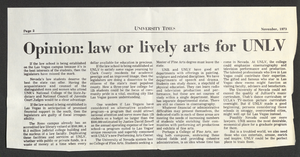
University of Nevada, Las Vegas law school establishment: correspondence, newspaper clippings, and reports
Date
Archival Collection
Description
Folder from the Jean Ford Papers (MS-00025) -- Political materials file.
Text