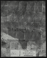
Search Results
Aerial view of the Las Vegas quadrant in Arizona-Nevada: photographic print
Date
1950
Archival Collection
Description
From the Army Mapping Service Aerial Photographs of Southern and Western Nevada (PH-00285). Aerial photographs, composites, and indices. High altitude aerial photographs, Quad. Las Vegas 2. State: Arizona - Nevada. U.S. Geologial Survey, Army Map Service. Flight Scale I-47200Project-GS-LJ. Index copied -8-26-50. Flying Comp. -7-26-50
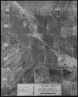
Image
Aerial view of the Las Vegas quadrant in Arizona-Nevada: photographic print
Date
1950
Archival Collection
Description
From the Army Mapping Service Aerial Photographs of Southern and Western Nevada (PH-00285). Aerial photographs, composites, and indices. High altitude aerial photographs, Quad. Las Vegas 1. State: Arizona - Nevada. U.S. Geologial Survey, Army Map Service. Flight Scale I-47200Project-GS-LJ. Index copied -8-26-50. Flying Comp. -7-26-50
Image
MGM Grand aerial footage: video
Date
1995 (year approximate) to 2005 (year approximate)
Archival Collection
Description
Aerial and street-level B-roll of the MGM Grand at night and during the daytime. Original media BetacamSP, color, aspect ratio 4 x 3, frame size 720 x 486. From the UNLV TV Audiovisual Collection (UA-00098) – Digitized audiovisual material file.
Moving Image
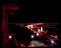
An aerial view of the Las Vegas Strip at night: photographic film
Date
1960 (year approximate) to 1986 (year approximate)
Archival Collection
Description
An aerial view of the Las Vegas Strip at night taken from the Hotel Flamingo looking north. For a southern view see Source ID 0220_0015, Digital ID pho026249.
Image
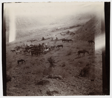
Aerial photograph of a railroad line camp, 1904
Date
1904
Archival Collection
Description
Aerial photograph of a railroad line camp, 1904
Image
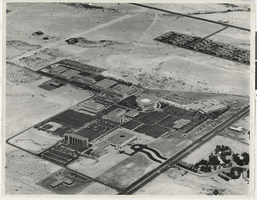
Aerial view of UNLV campus: photographic print
Date
1968
Archival Collection
Description
Aerial view of University of Nevada, Las Vegas.
Image
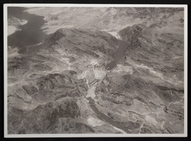
Aerial photograph of downstream face of Hoover Dam, circa 1933-1935
Date
1933 to 1935
Archival Collection
Description
Aerial view of the nearly completed Hoover Dam in Black Canyon prior to the release of water.
Image

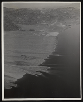
Photograph of an aerial view of Lake Mead, circa 1934-1950s
Date
1934 to 1959
Archival Collection
Description
An image showing an aerial view of Lake Mead amidst its home of rocky terrain. Varying rocky roads can be seen etched into the reservoir's shore.
Image