Search Results

David Weide holding up a map: photographic print
Date
Archival Collection
Description
Image
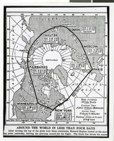
Photograph of a map showing the course of Howard Hughes' Round the World flight, circa 1938
Date
Archival Collection
Description
The black and white view of a map showing the path Howard Hughes took on his Round the World trip.
Image
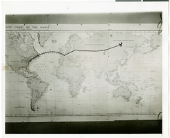
Photograph of a flight path map, July 1938
Date
Archival Collection
Description
Image
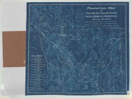
Prospectors map of Tonopah, Goldfield, Bull Frog, & principal mining districts
Date
Description
Showing towns, roads, trails & watering places, in southern Nevada & Death Valley region, California. 1 map ; 44 x 49 cm, folded in cover 18 x 11 cm. Scale [1:950,400]. 15 mi. to an inch. (W 119⁰--W 114⁰/N 39⁰--36⁰). Relief shown by hachures. Blueprint. "Jan. 1905." Includes list of distances. Goldfield, Nev. : Booker, Philbrick & Fenner.
Image

Coyote Springs development: maps
Date
Archival Collection
Description
Materials document issues surrounding the master-planned community of Coyote Springs in Lincoln County and Clark County, Nevada from 1988 to 2005. From the Jeff Van Ee Papers (MS-00470) -- Coyote Springs development -- Maps file.
Image
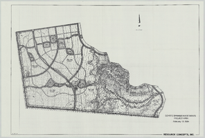
Coyote Springs Investments Project Area: map
Date
Archival Collection
Description
From the Jeff Van Ee Papers (MS-00470) -- Coyote Springs development -- Maps file.
Image
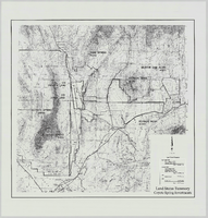
Land Status Summary, Coyote Spring Investments: map
Date
Archival Collection
Description
From the Jeff Van Ee Papers (MS-00470) -- Coyote Springs development -- Maps file.
Image
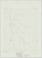
Wildcat Wash NW, Nev. (Fish & Wildlife #1 WSA): map
Date
Archival Collection
Description
From the Jeff Van Ee Papers (MS-00470) -- Coyote Springs development -- Maps file.
Image
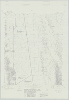
Wildcat Wash SW, Nev. (Fish & Wildlife #1 and #2 WSA): map
Date
Archival Collection
Description
From the Jeff Van Ee Papers (MS-00470) -- Coyote Springs development -- Maps file.
Image
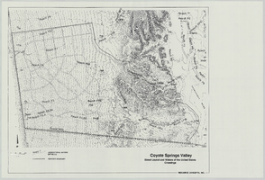
Coyote Springs Valley Street Layout & Waters of the United States Crossings: map
Date
Archival Collection
Description
From the Jeff Van Ee Papers (MS-00470) -- Coyote Springs development -- Maps file.
Image