Search Results
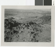
Aerial photograph of the Colorado River between Fortification Hill and Hemenway Wash, before 1930
Date
Archival Collection
Description
Aerial view of the Colorado River looking north between Fortification Hill and Hemenway Wash.
Image
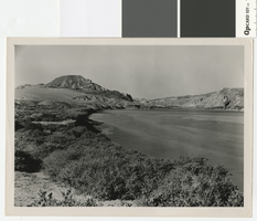
Photograph of the Colorado River above Black Canyon, before 1930
Date
Archival Collection
Description
Looking north up the Colorado River from Hemenway Wash.
Transcribed Notes: Typed inscription on back: "Nevada. Boulder Dam. The Colorado River above Black Canyon before construction of the dam."
Image
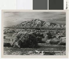
Photograph of Frenchman Mountain, Nevada, circa 1930's
Date
Archival Collection
Description
View of Frenchman Mountain from the southwest.
Transcribed Notes: Typed inscription on back: Dasjuoka Mountain
Image
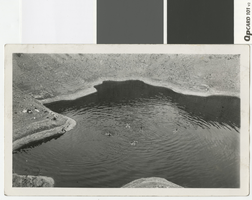
Photograph of swimmers in a salt water hole near the junction of the Virgin and Colorado Rivers, before 1938
Date
Archival Collection
Description
Five unidentified men swimming in pool near the salt mines near the confluence of the Virgin and Colorado Rivers.
Transcribed Notes: Handwritten inscription and signature on back: "Salt water hole, 1-mile west of Jct. Virgin and Col. Rivers." Signed Merle Frehner
Image
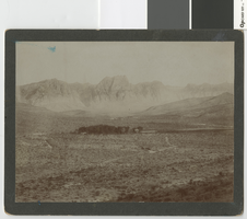
Photograph of Blue Diamond/Cottonwood Valley, Nevada, before 1930
Date
Archival Collection
Description
View looking northeast over Blue Diamond towards the Spring Mountains.
Image

Photograph of temporary shanty town along Colorado River, circa 1931
Date
Archival Collection
Description
Shack town filled with people waiting for jobs building the Hoover Dam.
Transcribed Notes: Written on back: 4-18-31
Image

Photograph of Hoover Dam worker beside the Colorado River, circa 1931
Date
Archival Collection
Description
Hoover Dam worker and an Ingersoll Rand electric generator beside the Colorado River looking Northwest towards the Hemenway Wash.
Transcribed Notes: Written on back: 4-18-31
Image
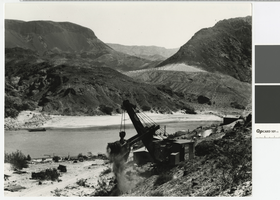
Photograph of steamshovel working on the road to the Hoover Dam construction site, circa 1931
Date
Archival Collection
Description
Steamshovel working on the road to the Hoover Dam construction site looking east over the Colorado River.
Transcribed Notes: Written on back: 4-18-31
Image
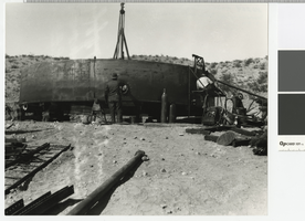
Photograph of construction of a water tank in Boulder City, circa 1931
Date
Archival Collection
Description
Construction of a water tank in Boulder City.
Transcribed Notes: Written on back: "3-13-31; Reservoir tank to supply Boulder City - Tanks on hill above Boulder City"
Image
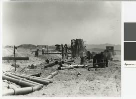
Photograph of men laying sewer pipe in Boulder City, circa 1931
Date
Archival Collection
Description
Laying a sewer line in Boulder City.
Transcribed Notes: Written on back: 10-12-31
Image