Search Results
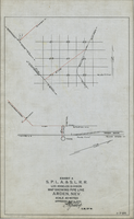
Map showing water pipeline in Arden, Nevada, May 4, 1913
Date
Archival Collection
Description
Image
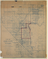
Map of Clark County, Nevada, 1927
Date
Description
Image

Blueprint map showing proposed new 12" well and pipe line changes at water springs, Las Vegas, Nevada, circa 1920
Date
Archival Collection
Description
Image
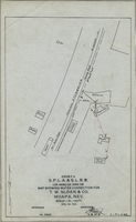
Map showing water connection for T. W. Sloan & Co., Moapa, Nevada, December 28, 1914
Date
Archival Collection
Description
Image

Map of Las Vegas Valley, Clark County, Nevada, October 1, 1940
Date
Archival Collection
Description
Image

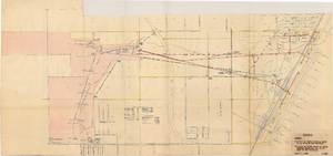
Blueprint map showing proposed water pipeline from Big Spring to Las Vegas, Nevada, January 24, 1911
Date
Archival Collection
Description
Image
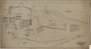
Map showing proposed improvement of Las Vegas Springs, Las Vegas, Nevada, September 21, 1916
Date
Description
'Exhibit A'. 'Approved Sept. 21, 1916.' 'W.E.J.'"--Lower left corner. 'L-44-50 to 61. T-75 - 17 & 46'--Upper left corner. Includes discharge figures and plans for improvements to springs Scale [ca. 1:240]. 1 in. to 20 feet. -- Scale [ca. 1:2,400]. 1 in. to 200 ft. Vertical scale [ca. 1:48]. 1 in. to 4 feet. -- Scale [ca. 1:4,800]. 1 in. to 100 feet. Library's copy has "Proposed layout" written on it in pencil near lower center and other markings in red. Contents: Detail at springs -- Profile -- Alignment.
Image
Map showing location of water-bearing lands to be sold to the Las Vegas Valley Water District, March 1, 1953
Date
Archival Collection
Description
Image

Plat showing original townsite and subdivisions, Las Vegas, Lincoln County, Nevada, May 1905
Date
Description
Land owned by the San Pedro, Los Angeles & Salt Lake Railroad is outlined. Scale: [ca. 1:12,000]. 1 inch = 1,000 feet. Cadastral map. Blueline print. Additional copy available in the J.T. McWilliams manuscript collection
Image
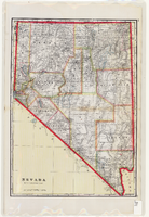
Map of Nevada, circa 1909
Date
Description
Text