Copyright & Fair-use Agreement
UNLV Special Collections provides copies of materials to facilitate private study, scholarship, or research. Material not in the public domain may be used according to fair use of copyrighted materials as defined by copyright law. Please cite us.
Please note that UNLV may not own the copyright to these materials and cannot provide permission to publish or distribute materials when UNLV is not the copyright holder. The user is solely responsible for determining the copyright status of materials and obtaining permission to use material from the copyright holder and for determining whether any permissions relating to any other rights are necessary for the intended use, and for obtaining all required permissions beyond that allowed by fair use.
Read more about our reproduction and use policy.
I agree.Information
Digital ID
Permalink
Details
More Info
Rights
Digital Provenance
Publisher
Transcription
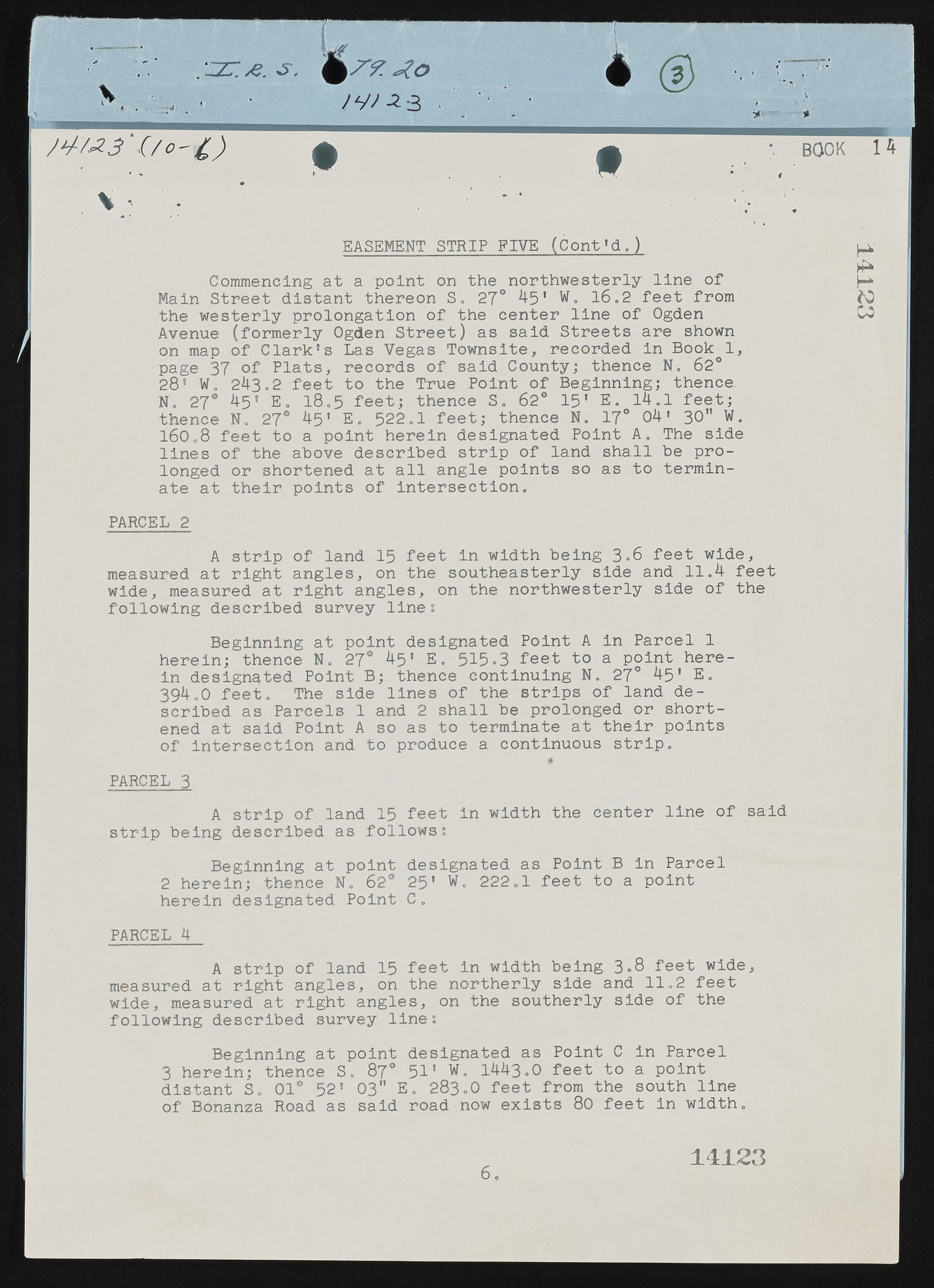
EASEMENT STRIP FIVE (Cont'd.) * BOOK 14 Commencing at a point on the northwesterly line of Main Street distant thereon S. 27° 4-5’ W. 16.2 feet from the westerly prolongation of the center line of Ogden CO Avenue (formerly Ogden Street) as said Streets are shown on map of Clark’s Las Vegas Townsite, recorded in Book 1, page 37 of Plats, records of said County; thence N„ 62° 28' W 0 243*2 feet to the True Point of Beginning; thence. N„ 27® 45’ E. l8o5 feet; thence S. 62° 15' E. 14.1 feet; thence N, 27® 45' E. 522,1 feet; thence N. 17° 04' 30" W. 160,8 feet to a point herein designated Point A. The side lines of the above described strip of land shall be prolonged or shortened at all angle points so as to terminate at their points of intersection. PARCEL 2 A strip of land 15 feet in width being 3.6 feet wide, measured at right angles, on the southeasterly side and 11.4 feet wide, measured at right angles, on the northwesterly side of the following described survey line ; Beginning at point designated Point A in Parcel 1 herein; thence N, 27° 45" E. 515*3 feet to a point herein designated Point B; thence continuing N. 27° 45' E, 394,0 feet. The side lines of the strips of land described as Parcels 1 and 2 shall be prolonged or shortened at said Point A so as to terminate at their points of intersection and to produce a continuous strip. PARCEL 3 A strip of land 15 feet in width the center line of said strip being described as follows; Beginning at point designated as Point B in Parcel 2 herein; thence N„ 62° 25* W. 222„1 feet to a point herein designated Point C„ PARCEL 4 A strip of land 15 feet in width being 3.8 feet wide, measured at right angles, on the northerly side and 1 1.2 feet wide, measured at right angles, on the southerly side of the following described survey line; Beginning at point designated as Point C in Parcel 3 herein; thence Si 87° 51* 1443.0 feet to a point distant S. 01® 52' 03" E. 283.0 feet from the south line of Bonanza Road as said road now exists 80 feet in width. 6. 14123 ZTfT

