Copyright & Fair-use Agreement
UNLV Special Collections provides copies of materials to facilitate private study, scholarship, or research. Material not in the public domain may be used according to fair use of copyrighted materials as defined by copyright law. Please cite us.
Please note that UNLV may not own the copyright to these materials and cannot provide permission to publish or distribute materials when UNLV is not the copyright holder. The user is solely responsible for determining the copyright status of materials and obtaining permission to use material from the copyright holder and for determining whether any permissions relating to any other rights are necessary for the intended use, and for obtaining all required permissions beyond that allowed by fair use.
Read more about our reproduction and use policy.
I agree.Information
Digital ID
Permalink
Details
Member of
More Info
Rights
Digital Provenance
Publisher
Transcription
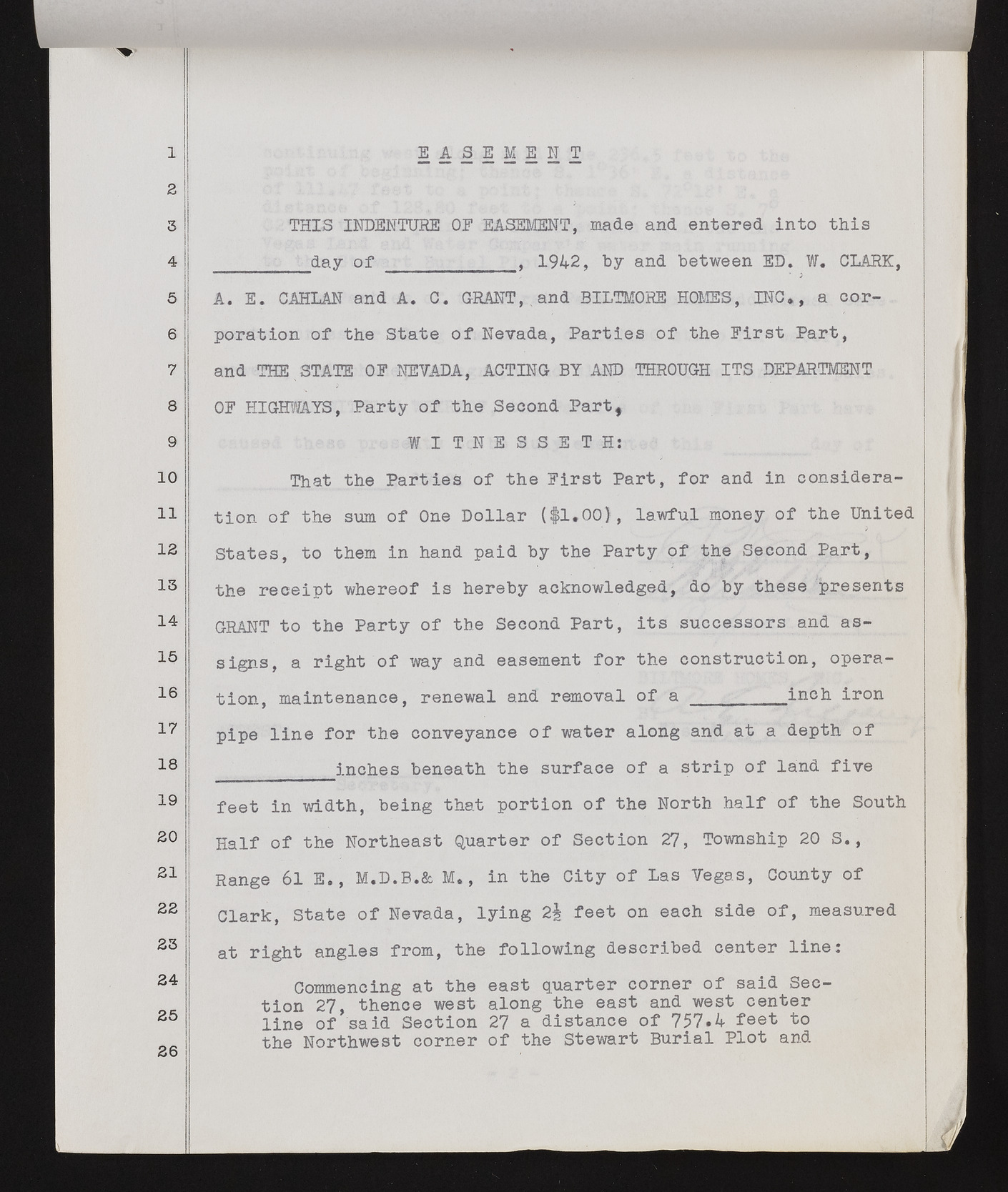
1 z 3 4 5 6 7 8 9 10 11 12 13 14 15 16 17 18 19 20 21 22 23 24 25 26 E A S E M E N T THIS INDENTURE 0E EASEMENT, made and entered into this day of , 1942, by and between ED. W* CLARK, A. E. CAHLAN and A. C. GRANT,, and BILTMORE HOMES, INC*, a corporation of the State of Nevada, Parties of the Eirst Part, and THE . STATE OE NEVADA, ACTING BY AND THROUGH ITS DEPARTMENT OE HIGHWAYS, Party of the Second Part* WITNESSETH: That the Parties of the Eirst Part, for and in consideration of the sum of One Dollar (#1.00), lawful money of the United States, to them in hand paid by the Party of the Second Part, the receipt whereof is hereby acknowledged, do by these presents GRANT to the Party of the Second Part, its successors and assigns, a right of way and easement for the construction, operation, maintenance, renewal and removal of a _________inch iron pipe line for the conveyance of water along and at a depth of inches beneath the surface of a strip of land five feet in width, being that portion of the North half of the South Half of the Northeast Quarter of Section 27, Township 20 S., Range 61 E., M.D.B.& M*, in the City of Las Vegas, County of Clark, State of Nevada, lying 2% feet on each side of, measured at right angles from, the following described center line: Commencing at the east quarter corner of said Section 27, thence west along the east and west center line of said Section 27 a distance of 757.4 feet to the Northwest corner of the Stewart Burial Plot and

