Copyright & Fair-use Agreement
UNLV Special Collections provides copies of materials to facilitate private study, scholarship, or research. Material not in the public domain may be used according to fair use of copyrighted materials as defined by copyright law. Please cite us.
Please note that UNLV may not own the copyright to these materials and cannot provide permission to publish or distribute materials when UNLV is not the copyright holder. The user is solely responsible for determining the copyright status of materials and obtaining permission to use material from the copyright holder and for determining whether any permissions relating to any other rights are necessary for the intended use, and for obtaining all required permissions beyond that allowed by fair use.
Read more about our reproduction and use policy.
I agree.Information
Digital ID
Permalink
Details
More Info
Rights
Digital Provenance
Publisher
Transcription
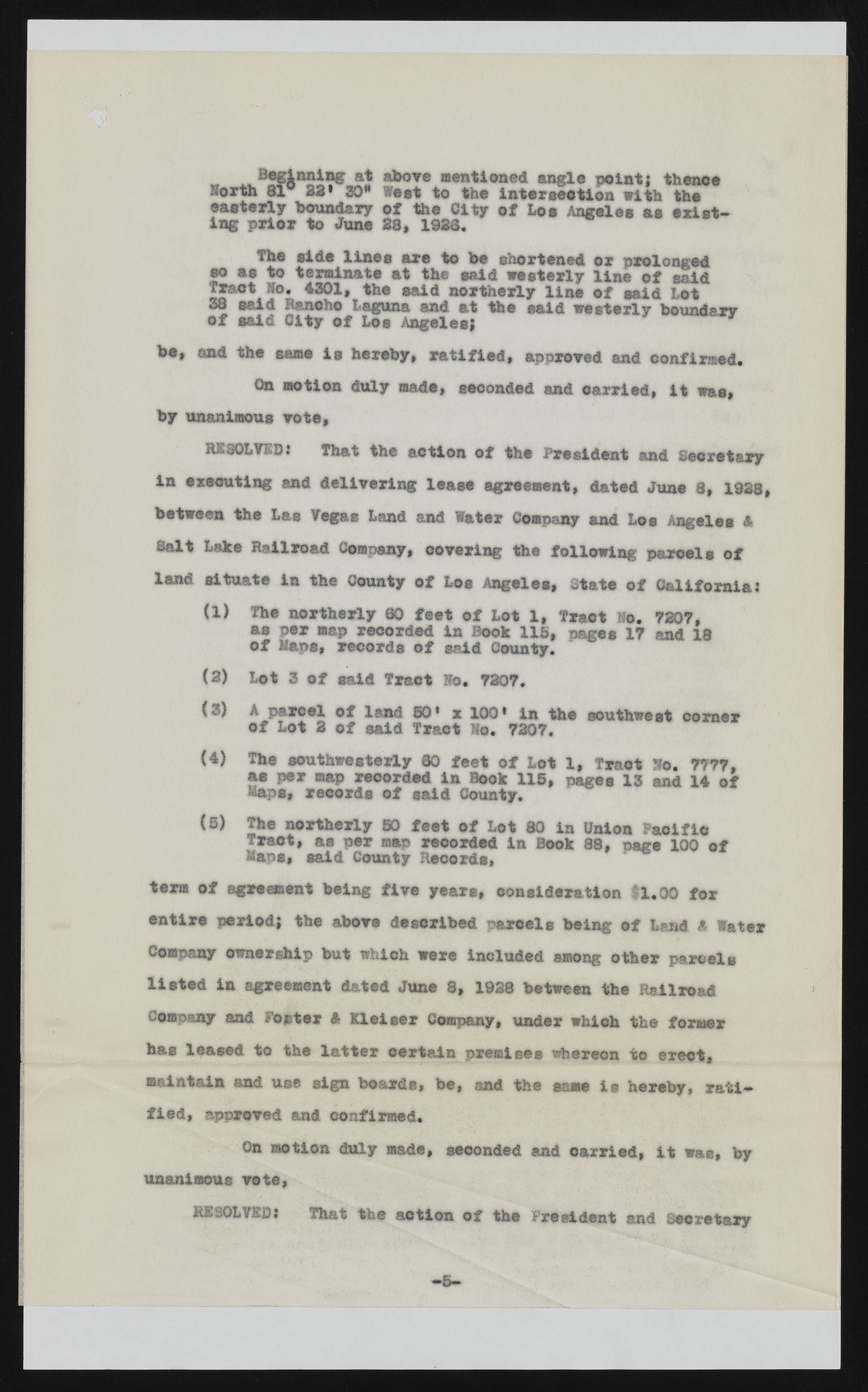
« ? jJ S m ti& S G f§ aboTe mentioned angle Korth 81° S3* 30* West to the intersect ioponi nwti;t h thtehen ce ienags tperrilyo rb otuo ndJaurnye o23f, t1h9e3 60.1 ty of Los Angeles as existThe side lines are to be shortened or prolonged so as to terminate at the said westerly line of said Tract Ho, 4301, the said northerly line of maid Lot o28f ssaaiidd RCaintcyh oo fL aLogsu naAn gaenlde sa;t the said westerly boundary be, and the same is hereby, ratified, approved and confirmed. On motion duly made, seconded and carried, it was, by unanimous vote, RESOLVED: That the action of the President and Secretary in executing and delivering lease agreement, dated June 8, 1928, between the Las Vegas Land and Water Company and Los Angeles 4 Salt Lake Railroad Company, covering the following parcels of land situate in the County of Los Angeles, State of California: (1) The northerly 60 feet of Lot 1, Tract Ho. 7307, as per map recorded in Book US, pages 17 and 18 of Haps, records of said County. (2) Lot 3 of said Tract Ho. 7307. (3) A pared of land 50* x 100* in the southwest comer of Lot 3 of said Tract Ho. 7307. (4) The southwesterly 80 feet of Lot 1, Traot Ho. 7777, Maasp sp,e rr emcaopr drse coofr desdai di nC oBuonotky .115, pages 13 and 14 of (5) The northerly SO feet of Lot 80 in Union Pacific Tract, as per map recorded in Book 88, page 100 of Maps, said County Records, term of agreement being five years, consideration 11.00 for entire period; the above described parcels being of Land i Water Company ownership but which were included among other parcels listed in agreement dated June 8, 1938 between the Railroad Company and Foster 4 Kleieer Company, under which the former has leased to the latter certain premises whereon to erect, maintain and use sign boards, be, and the same is hereby, ratified, approved and confirmed. On motion duly made, seconded and carried, it was, by unanimous vote, RESOLVED: That the action of the President and Secretary —1 »

