Copyright & Fair-use Agreement
UNLV Special Collections provides copies of materials to facilitate private study, scholarship, or research. Material not in the public domain may be used according to fair use of copyrighted materials as defined by copyright law. Please cite us.
Please note that UNLV may not own the copyright to these materials and cannot provide permission to publish or distribute materials when UNLV is not the copyright holder. The user is solely responsible for determining the copyright status of materials and obtaining permission to use material from the copyright holder and for determining whether any permissions relating to any other rights are necessary for the intended use, and for obtaining all required permissions beyond that allowed by fair use.
Read more about our reproduction and use policy.
I agree.Information
Digital ID
Permalink
Details
Member of
More Info
Rights
Digital Provenance
Publisher
Transcription
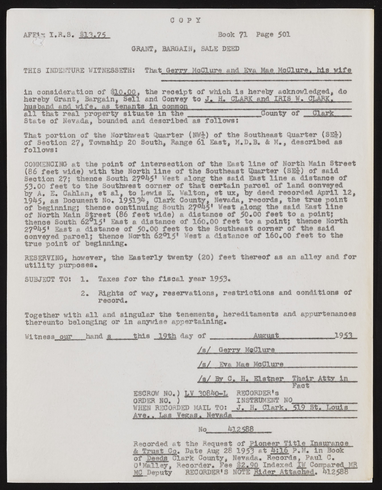
C O P Y AFP*n I.R.S. $11.75 BooK 71 Page 501 GRANT, BARGAIN, BALE DEED THIS INDENTURE WITNESSETH: That Gerry McClure and Eva Mae McClure. hlawlfe in consideration of ilQ.QQ. the receipt of which la hereby acknowledged, do hereby Grant, Bargain, Sell and Convey to J. H. CLARK and IRIS W» CLARK, husband and wife, as tenants in common all that real pro;party situate In the State of Nevada, bounded and described as follows: .County of That portion of the Northwest Quarter (NW§) of the Southeast Quarter (8S|) of Section 27# Township 20 South, Range 61 East, K.D.S. & M., described as follows s COMMENCING at the point of intersection of the East line of North Main Street (86 feet wide) with the North line of the Southeast Quarter (SS&) of said Section thence South 27°h5* West along the said East line a distance of 53*00 feet to the Southwest corner of that certain parcel of land conveyed by A. B. Cahlan, et al, to Lewis E. Walton, et ux, by deed recorded April 12, 19^5, as Document No. 19513^, Clark County, Nevada, records, the true point of beginning! thence continuing South 2?°hy West along the said East line of North Main Street (86 feet wide) a distance of 50.00 feet to a point? thence South 62°15* East a distance of 160.00 feet to a point; thence North 27°^5* last a distance of 50.00 feet to the Southeast corner of the said conveyed parcel; thence North 62°!5* West a distance of 160.00 feet to the true point of beginning. RESERVING, however, the Easterly twenty (20) feet thereof as an alley and for utility purposes. SUBJECT TO: 1. Taxes for the fiscal year 1953* 2. Rights of way, reservations, restrictions and conditions of record. Together with all and singular the tenements, hereditaments and appurtenances thereunto belonging or in anywise appertaining. Witness our hand s ....this .19th day of ....... August.............19.5.1.... /s/ Gerry MoClure j&L Eva. Mae McClure /a/ By C. _H. Elstner. Their. At_ty„jjL_ Pact ESCROW NO.) LV 1089O-L RECORDER'S ORDER NO. ) INSTRUMENT NO________ .. . WHEN RECORDED MAIL TGI J. H* Clark.* 519M.. Louis ...-------------------------------------------------------------------------------------------------------------------------- hq....jg___ Recorded at the Request of Pioneer T1 tie.. Inanra.no.s_., & Trust Co. Date Aug 28 1951 at h:16 P.M. in Book of Deads':Clark County, Nevada. Records, Paul 0. 01 Halley, Recorder* Fee 12.90 Indexed 1¥ Compared .KR MO Deputy RECORDER* 3 NOTE Rider Attached. 9-12588

