Copyright & Fair-use Agreement
UNLV Special Collections provides copies of materials to facilitate private study, scholarship, or research. Material not in the public domain may be used according to fair use of copyrighted materials as defined by copyright law. Please cite us.
Please note that UNLV may not own the copyright to these materials and cannot provide permission to publish or distribute materials when UNLV is not the copyright holder. The user is solely responsible for determining the copyright status of materials and obtaining permission to use material from the copyright holder and for determining whether any permissions relating to any other rights are necessary for the intended use, and for obtaining all required permissions beyond that allowed by fair use.
Read more about our reproduction and use policy.
I agree.Information
Digital ID
Permalink
Details
More Info
Rights
Digital Provenance
Publisher
Transcription
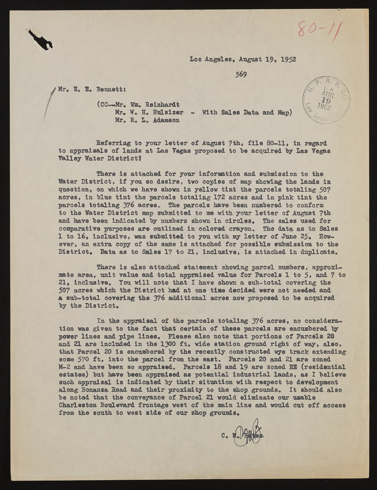
Mr* 1. 1. Bennett Los Angeles* August 19* 1952 569 (GC— Mr. Wm. Reinhardt Mr* ¥, H, Hulsizer Mr, 1, L. Adamson With Sales Bata and Map) Deferring to your letter of August 7th* file 80-11, in regard to appraisals of lands at Las Tegas proposed to he acquired Talley Water District! by Las Yegas There is attached for your information and submission to the Water District* if you so desire, two copies of map showing the lands in question* on which we have shown in yellow tint the parcels totaling 50? acres* in blue tint the parcels totaling 172 acres and in pink tint the parcels totaling 376 acres. The parcels hare been numbered to conform to the Water District map submitted to me with your letter of August 7th and hare been indicated by numbers shown in circles* The sales used for comparative purposes are outlined in colored crayon. The data as to Sales 1e vetro, 16a*n ienxctlruas icvoep,y woafs thseu bmsaimtet edis tao tytaocuh ewdi thfo mr yp olsestitbelre osf uJbumnies s2i5o*n tHoo wthe District* Data as to Sales 17 to 21, inclusive, is attached in duplicate. mate area, Tuhneirte viasl uael saon adt ttaoctahle da psptraatiemseendt vaslhuoew ifnogr p Paarrcceell sn u1m betros ,5 , aapnprdo x7i to 21* inclusive, Tou will note that I have shown a sub-total covering the a50 7s uabc-rteost awl hiccohv etrhien gD itshter i3c7t6 haadddi atti onoanle atcirmees d encoiwd perdo wpeorsee dn otto bnee eadceqdu ainrde d by the District. tion was giIvne nt hteo aptphre aifsacatl tohfa tt hcee pratracienl so f ttohteaslei npga r3c7e6l sa carerse, enncou mcboenrseidd ebryapaonwde r21 lairnees ianncdlu pdiepde ilni ntehse* 13P0l0 eafts.e awlisdoe nsottaet itohna tg rpoourntdi ornigsh to fo Pfa rwacye,l sa l2s6o * sthoamte P5a7r0c eflt, 20i nitso etnhec upmabreereeld bfyro mt het her eceaesntt.l y Pcaorncsetlrsu c2t0e da nwyde 21t raarcek ezxonteednding M-2 and have been so appraised. Parcels 18 and 19 are zoned BIS (residential essutcaht easp)p rabiusta lh avies bienednic aaptperda biyse dth aesi rp ostietnutaitailo ni wnidtusht rreisaple clatn dtso, deavse lIo pbmeelniteve along Bonanza Hoad and their proximity to the shop grounds. It should also be noted that the conveyance of Parcel 21 would eliminate our usable Charleston Boulevard frontage west of the main line and would cut off access from the south to west side of our shop grounds*

