Copyright & Fair-use Agreement
UNLV Special Collections provides copies of materials to facilitate private study, scholarship, or research. Material not in the public domain may be used according to fair use of copyrighted materials as defined by copyright law. Please cite us.
Please note that UNLV may not own the copyright to these materials and cannot provide permission to publish or distribute materials when UNLV is not the copyright holder. The user is solely responsible for determining the copyright status of materials and obtaining permission to use material from the copyright holder and for determining whether any permissions relating to any other rights are necessary for the intended use, and for obtaining all required permissions beyond that allowed by fair use.
Read more about our reproduction and use policy.
I agree.Information
Digital ID
Permalink
Details
Member of
More Info
Rights
Digital Provenance
Publisher
Transcription
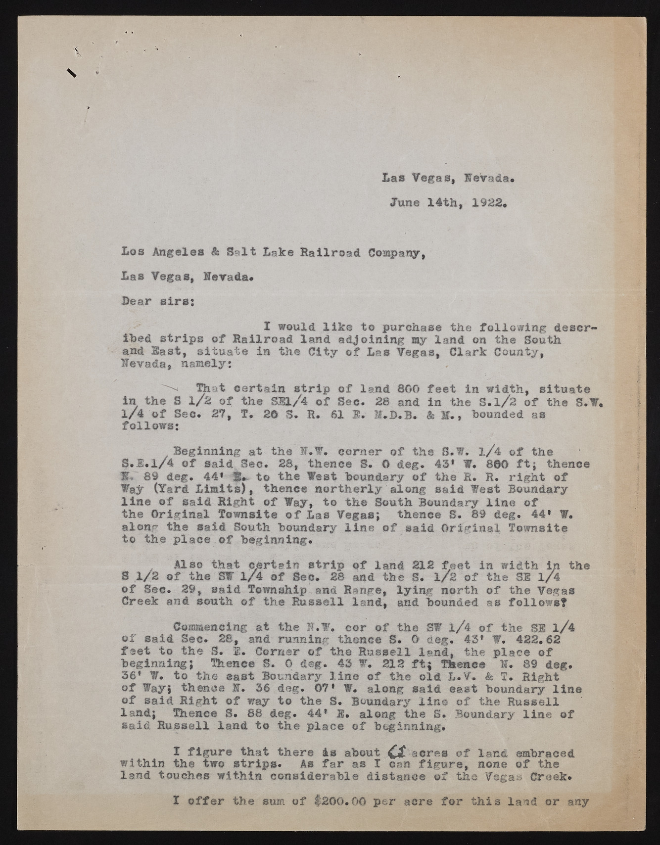
Las Vegas, Nevada. June 14th, 1922* Los Angeles & Salt Lake Railroad Company, Las Vegas, Nevada* Lear sirs: I would like to purchase the following described strips of Railroad land adjoining my land on the South and East, situate in the City of Las Vegas, Clark County, Nevada, namely: That certain strip of land 800 feet in width, situate in the S 1/2 of the SS1/4 of Sec. 28 and in the S.l/2 of the S.W. 1/4 of See. 27, T. 26 S. R. 61 $. M,L.B. & M., bounded as follows: Beginning at the N.W. corner of the S.W. l/4 of the S.1.1/4 of said Sec. 28, thence S. O deg. 43* W. 800 ft; thence l|. 89 deg. 44' 3*> to the West boundary of the R. R. right of ¥ajr (Yard Limits), thence northerly along said Vest Boundary line of said Right of Way, to the South Boundary line of the Original Townsite of Las Vegas; thence S. 89 deg. 44' W. along the said South boundary line of said Original Townsite to the place of beginning. Also that certain strip of land 212 feet in width in the S 1/2 of the S¥ l/4 of Sec. 28 and the S. 1/2 of the SI 1/4 of Sec. 29, said Township and Range, lying north of the Vegas Creek and south of the Russell land, and bounded as follows? Commencing at the N.V. cor of the S¥ l/4 of the SI l/4 of said Sec. 28, and running thence S. O deg. 43* V. 422.62 feet to the S. 1. Corner of the Russell land, the place of beginning; Thence S. 0 deg. 43 W. 212 ft; Thence N. 89 deg. 36* W. to the east Boundary line of the old L.V. & T. Right of Way; thence N. 36 deg. 07* W. along said east boundary line of said Right of way to the S. Boundary line of the Russell land; Thence S. 68 deg. 44* 2g, along the S. Boundary line of said Russell land to the place of beginning, I figure that there 4s about a acres of land embraced within the two strips. As far as I can figure, none of the land touches within considerable distance of the Vegas Creek* I offer the sum of $200.00 per acre for this land or any

