Copyright & Fair-use Agreement
UNLV Special Collections provides copies of materials to facilitate private study, scholarship, or research. Material not in the public domain may be used according to fair use of copyrighted materials as defined by copyright law. Please cite us.
Please note that UNLV may not own the copyright to these materials and cannot provide permission to publish or distribute materials when UNLV is not the copyright holder. The user is solely responsible for determining the copyright status of materials and obtaining permission to use material from the copyright holder and for determining whether any permissions relating to any other rights are necessary for the intended use, and for obtaining all required permissions beyond that allowed by fair use.
Read more about our reproduction and use policy.
I agree.Information
Digital ID
Permalink
Details
Member of
More Info
Rights
Digital Provenance
Publisher
Transcription
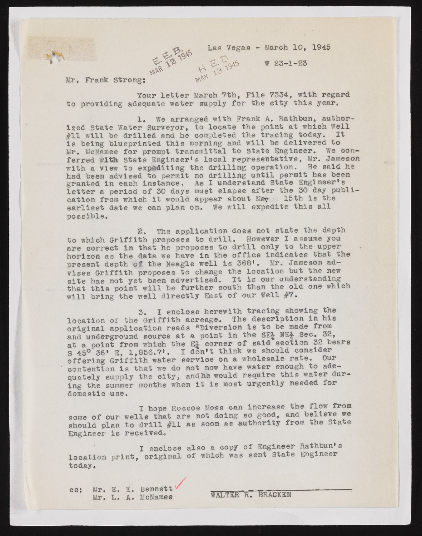
Las Vegas - March 10, 1945 Mr, Frank strong: Your letter March 7th, File 7334, with regard to providing adequate water supply for the city this year. ized State Water Surveyor, to locate the point at which Well #11 will he drilled and he completed the tracing today. It Is being blueprinted this morning and will be delivered to Mr, lieNamee for prompt transmittal to State Engineer, We conferred with State Engineer’s local representative, Mr, Jameson with a view to expediting the drilling operation. He said he had been advised to permit no drilling until permit has been granted In each instance. As I understand State Engineer’s letter a period of 30 days must elapse after the 30 day publication from which It would appear about May 15th is the earliest date we can plan on. We will expedite this all possible, 2. The application does not state the depth to which Griffith proposes to drill. However I assume you are correct in that he proposes to drill only to the upper horizon as the data we have In the office Indicates that the present depth of the If eagle well Is 368’. Mr. Jameson advises Griffith proposes to change the location but the new site has not yet been advertised. It Is our understanding that this point will be further south than the old one which will bring the well directly East of our Well #7. location of the Griffith acreage. The description in his original application reads "Diversion Is to be made fro® and underground source at a point In the SE^ NE4 Sec, 32, at a point from which the E4 corner of said section 32 bears S 45° 36' E, 1,856.7’, I don’t think we should consider offering Griffith water service on a wholesale rate. Our contention is that we do not now have water enough to adequately supply the city, andhh would require this water during the summer months when it is most urgently needed for domestic use. some of our wells that are not doing so good, and believe we should plan to drill #11 as soon as authority from the State Engineer is received. I enclose also a copy of Engineer Rathbun’s location print, original of which was sent State Engineer 1. fe arranged with Frank A. Rathbun, author- 3. I enclose herewith tracing showing the I hope Roscoe Moss can increase the flow from today cc: Mr. E. E. Bennett / Mr. L. A. MeNamee . BRACKEN

