Copyright & Fair-use Agreement
UNLV Special Collections provides copies of materials to facilitate private study, scholarship, or research. Material not in the public domain may be used according to fair use of copyrighted materials as defined by copyright law. Please cite us.
Please note that UNLV may not own the copyright to these materials and cannot provide permission to publish or distribute materials when UNLV is not the copyright holder. The user is solely responsible for determining the copyright status of materials and obtaining permission to use material from the copyright holder and for determining whether any permissions relating to any other rights are necessary for the intended use, and for obtaining all required permissions beyond that allowed by fair use.
Read more about our reproduction and use policy.
I agree.Information
Digital ID
Permalink
Details
More Info
Rights
Digital Provenance
Publisher
Transcription
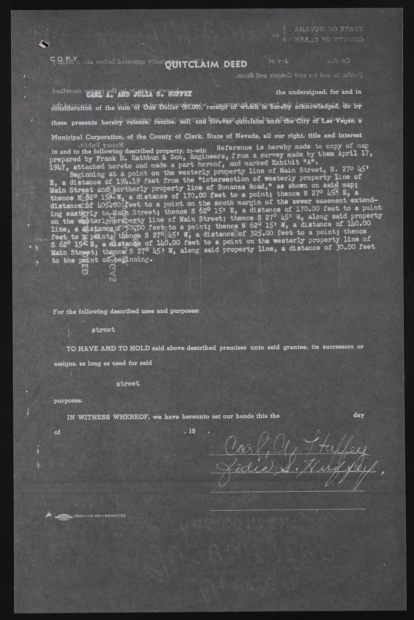
13 C Q,FUY. AGAVaW | 0 37AT2 St 3 A JO l b YTwUQO LotBOQqB $€HTCLAIM DEED io y b .atsiS fans viciroO b-;83 10I fc-ii ni .aifdy-I jbediiofi9b 'vIJP»OfMfil Ag«di dU a s. hustst the undersigned, for and in <?c$s$>d6!'aft6n of the Wiinftfif ^ ^ 7-^ lIiS a(!^tW,wrec69$F,;GSf E<iiifiSItfi86^relfy ibkhd^bdgeef, &b by these presents hereby reteSsU1 BeftTafiel %Hie$i^<^lcIa6xlr' S f L a H VegHir. *• Municipal Corporation, of the County of Clark, State of Nevada, all our right, title and interest in and to. atihled fvqo lYloMwtiongW described property, io-wit: Reference is„ ,«h«e«r«e,b mya mna«d eh vt to hceomp Ayo orfi lm a1p7. prepared by Frank D. Rathbun & Son, Engineers, from ^ survey made by them April if, 19U7, Baetgtiancnhiendg haetr eat op oainndt moand et hae wpeasrtte rhleyr,e opfr,o paenrdt ym alriknee of Main SSttrreeeett, NN . 2277 ° li$» B a distanced 19k *19 feet from the "intersection of westerly property line of Main Street andOkortherly property line of Bonansa Road, m i ehoim on 1w d # m p, thencs 1& 20 idCw, a distance of 170.00 feet to a point} thence N 27 U5S S, * distanced UoSoofeeet to a point on the south margin of the sewer easement extend- ^ J w S l y S a | Street, thence S 62° 15* B, a distance of 170.00 feet to a pornt o n ^ t h r S t l r l y w ^ e s t y line of Main Street} thence 3 27° U5* W, along said property Sne. a ^ ^ S f ^ o i o feetgto a point, thence N 629 15* W, a distance of lUO.OO feet to ® p f t n t S t S S ^ S 27°|U5* Wi a distance?of 325.00 feet to a point, Whence S 62° 15* E 7 a distunes of lUO.OO feet: to a point on the westerly property lije of L i n S t ^ t , thfipc<?S 270 U5‘ V, along; said property line, a distance of 30.00 feet to the point o^e^n n i n g . m Q - O < ? For the following described uses and purposes: street m TO HAVE AND TO HOLD said above described premises unto said grantee, its successors or assigns, as long as used for said street purposes. IN WITNESS WHEREOF, we have hereunto set our hands this the of . 19 , U . ?> 1500------1 0 -4 8 ------ B R IM M IE S

