Copyright & Fair-use Agreement
UNLV Special Collections provides copies of materials to facilitate private study, scholarship, or research. Material not in the public domain may be used according to fair use of copyrighted materials as defined by copyright law. Please cite us.
Please note that UNLV may not own the copyright to these materials and cannot provide permission to publish or distribute materials when UNLV is not the copyright holder. The user is solely responsible for determining the copyright status of materials and obtaining permission to use material from the copyright holder and for determining whether any permissions relating to any other rights are necessary for the intended use, and for obtaining all required permissions beyond that allowed by fair use.
Read more about our reproduction and use policy.
I agree.Information
Digital ID
Permalink
Details
Member of
More Info
Rights
Digital Provenance
Publisher
Transcription
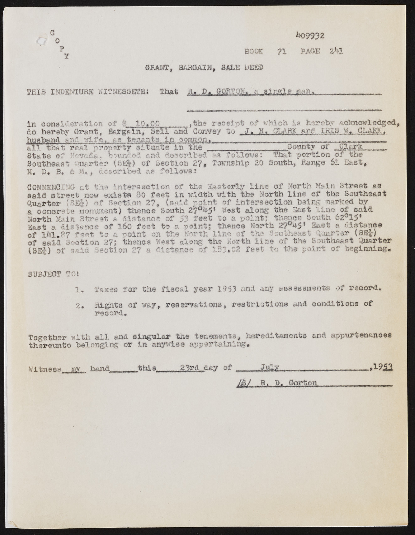
c0 p Y **09932 BOOK 71 PAGE 2*& GRANT, BARGAIN, SALE DEED THIS INDENTURE WITNESSETH* That R.« D«. GORTON,, g tingle man, In consideration of I 10.00______,the receipt of ?which is hereby acknowledged, do hereby Grant, Bargain, Sell and Convey to . J... 11» CLAM,jmd_.XEIS W,,. CLARK., husband and wife, as tenants in common., ................^... all that real property situate In the County of „ Clark____ State of Nevada, branded and described as follows: That portion of the Southeast Quarter (8E|) of Section 27, Township 20 South, Range 61 East, M. D. B. & M., described &e follows: COMMENCING at the intersection of the Easterly line of North Main Street as said street now exists 80 feet In width with the North line of the Southeast Quarter (Sl|) of Section 27, (said point of Intersection being marked by a conorete monument) thence South 27°**5* West along the East line of said North Main Street a distance of 53 to a point; thence South 62°15* East a distance of l6o feet to a of lhl.87 feet to a of said Section 27; point on the point; North thence ?of North 27°^5’ East a distance line the Sout: thence West along the North line of least Quarter (8E|) the Southeast Quarter (SEj) of said Section o*7 C ( distance of 183*02 feet to the point of beginning, SUBJECT TO: 1. Taxes for the fiscal year 1953 and any assessments of record, 2. Rights of way, reservations, restrictions and conditions of record. Together with all and singular the tenements, hereditaments and appurtenances thereunto belonging or In anywise appertaining. Witness my hand this....23rdday of .....July......j...........A9i2 Jk Sk P. Gorton----------------

