Copyright & Fair-use Agreement
UNLV Special Collections provides copies of materials to facilitate private study, scholarship, or research. Material not in the public domain may be used according to fair use of copyrighted materials as defined by copyright law. Please cite us.
Please note that UNLV may not own the copyright to these materials and cannot provide permission to publish or distribute materials when UNLV is not the copyright holder. The user is solely responsible for determining the copyright status of materials and obtaining permission to use material from the copyright holder and for determining whether any permissions relating to any other rights are necessary for the intended use, and for obtaining all required permissions beyond that allowed by fair use.
Read more about our reproduction and use policy.
I agree.Information
Digital ID
Permalink
Details
More Info
Rights
Digital Provenance
Publisher
Transcription
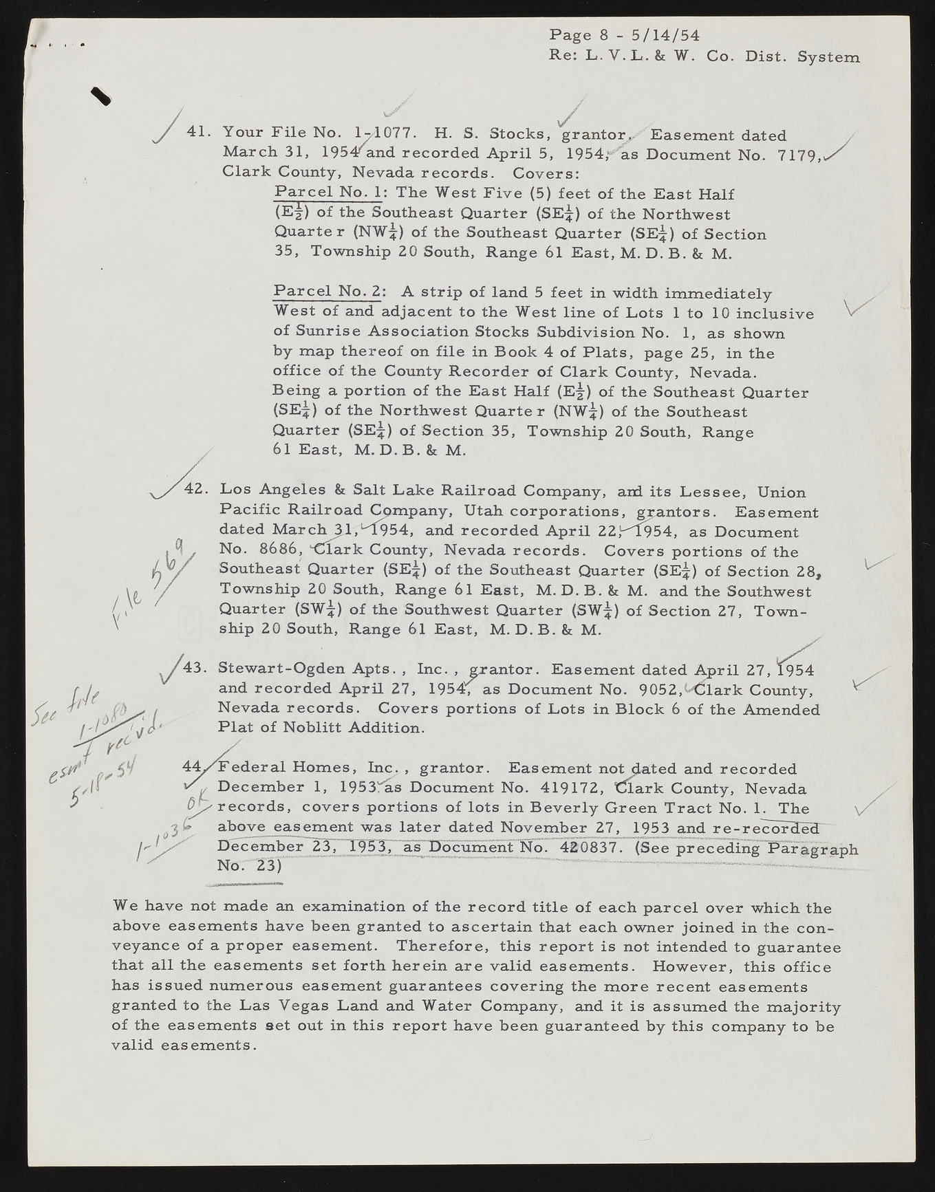
Page 8 - 5/14/54 Re: L . V . L . & W. Co. Dist. System •/ - i ? / ' ' . ' I :ir ' • /J| w y 41. Your F ile No. 1-/1077. H. S. Stocks, grantor*. Easement dated March 31, 1954^and recorded A p ril 5, 1954,'"’ as Document No. 7179,,/ C lark County, Nevada records. Covers: P a rc e l No. 1: The West F iv e (5) feet of the East H alf (E f ) of the Southeast Quarter (SE^) of the Northwest Q uarter (NW?) of the Southeast Quarter (SEjj) of Section 35, Township 20 South, Range 61 East, M. D. B. & M. P a rc e l No. 2: A strip of land 5 feet in width im m ediately West of and adjacent to the West line of Lots 1 to 10 inclusive of Sunrise Association Stocks Subdivision No. 1, as shown by map thereof on file in Book 4 of Plats, page 25, in the office of the County R ecord er of Clark County, Nevada. Being a portion of the East H alf (E^) of the Southeast Quarter (SEjf) o f the Northwest Q uarter (NW^) of the Southeast Quarter (SE^) of Section 35, Township 20 South, Range 61 East, M. D. B. & M. Los Angeles & Salt Lake Railroad Company, and its Lessee, Union P a cific R ailroad Company, Utah corporations, grantors. Easement dated M a r c h ^ l,uT954, and recorded A p ril 22,^954, as Document No. 8686, ‘-Clark County, Nevada records. C overs portions of the Southeast Quarter (SE^) of the Southeast Quarter (SE|) of Section 28, Township 20 South, Range 6 l East, M. D .B . & M. and the Southwest Quarter (SW^) of the Southwest Quarter (SWjf) of Section 27, Township 20 South, Range 6 l East, M. D. B. & M. Stewart-Ogden Apts. , Inc. , grantor. Easement dated April 27, 19544 and recorded A p ril 27, 1954, as Document No. 9052,k<5lark County, Nevada records. C overs portions of Lots in B lock 6 of the Amended P la t of Noblitt Addition. F ed eral Homes, Inc. , grantor. Easement not dated and recorded Decem ber 1, 1953^as Document No. 419172, t^lark County, Nevada records, covers portions of lots in B ev erly Green T ra ct No. 1. The above easement was later dated Novem ber 27, 1953 and r e - recorcfedT December~2Jj_ 195T37* as Uocument No. 420837. (See preceding Paragraph No. 23) We have not made an examination of the record title of each parcel over which the above easements have been granted to ascertain that each owner joined in the conveyance of a proper easement. T h erefore, this report is not intended to guarantee that all the easements set forth herein are valid easements. However, this office has issued numerous easement guarantees covering the m ore recent easements granted to the Las Yegas Land and Water Company, and it is assumed the m ajority of the easements set out in this report have been guaranteed by this company to be valid easements.

