Copyright & Fair-use Agreement
UNLV Special Collections provides copies of materials to facilitate private study, scholarship, or research. Material not in the public domain may be used according to fair use of copyrighted materials as defined by copyright law. Please cite us.
Please note that UNLV may not own the copyright to these materials and cannot provide permission to publish or distribute materials when UNLV is not the copyright holder. The user is solely responsible for determining the copyright status of materials and obtaining permission to use material from the copyright holder and for determining whether any permissions relating to any other rights are necessary for the intended use, and for obtaining all required permissions beyond that allowed by fair use.
Read more about our reproduction and use policy.
I agree.Information
Digital ID
Permalink
Details
More Info
Rights
Digital Provenance
Publisher
Transcription
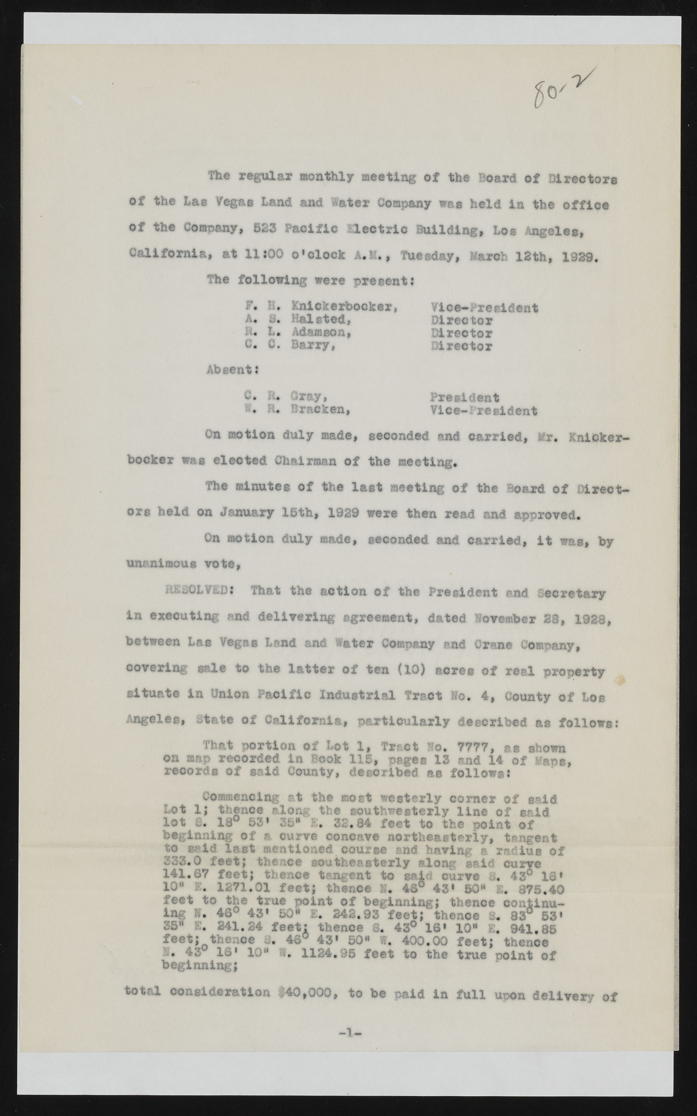
Skil Hie regular monthly meeting of the Board of Director® of the Las Vegas Land and later Company was held in the office of the Company, 523 Pacific electric Building, Los Angeles, California, at 1UQ0 o’olock A.M., Tuesday, March 12th, 1929. The following were present? F. H, Knickerbocker, A. S. Halsted, 11* L. Adamson, 0. C. Barry, Absent: C. Ft. Gray, i. H. Bracken, Vice-*• resident Director Dire© tor Director President Vice-President On motion duly made, seconded and carried, Mr* Knickerbocker was elected Chairman of the meeting. The minutes of the last meeting of the Board of Directors held on January 15th, 1929 were then read and approved. On motion duly made, seconded and carried, it was, by unanimous vote, RESOLVED: That the action of the President end Secretary in executing and delivering agreement, dated November S i, 1928, between Las Vegas Land and Water Company and Crane Company, covering sale to the latter of ten (10) acres of real property situate in Union P acific Industrial Tract Mo. 4, County of Los Angeles, state of California, particularly described as follows: That portion of Lot 1, Tract No. 7777, as shown on map recorded in Book 115, pages 13 and 14 of Mans, records of said County, described as follows: Commencing at the moft westerly corner of said Lot 1; thence along the southwesterly line of said lot a. 18° 53* 35“ 1. 32.84 feet to the point of beginning of a curve concave northeasterly, tangent to said last mentioned course and having a radius of 333.0 feet; thence southeasterly along ©aid' curve 141.67 feet; thence tangent to said curve i, 43® 16* 10" 1, 1271.01 feet; thence S* 46s 43* 50" E. 875.40 feet to the true point of beginning; thence continua l ?• If? 43* 5°« 1* 242.93 feet; thence 8. 83° 53* S. 43° 16* 10" E. 941.85 vi. 400.00 feet; thence 10" 1124.95 feet to the true point of E. 241.24 feet: thence feet; thence 8. 46° 43* 50" I. 43° 16* beginning; total consideration $40,000, to be paid in full upon delivery of

