Copyright & Fair-use Agreement
UNLV Special Collections provides copies of materials to facilitate private study, scholarship, or research. Material not in the public domain may be used according to fair use of copyrighted materials as defined by copyright law. Please cite us.
Please note that UNLV may not own the copyright to these materials and cannot provide permission to publish or distribute materials when UNLV is not the copyright holder. The user is solely responsible for determining the copyright status of materials and obtaining permission to use material from the copyright holder and for determining whether any permissions relating to any other rights are necessary for the intended use, and for obtaining all required permissions beyond that allowed by fair use.
Read more about our reproduction and use policy.
I agree.Information
Digital ID
Permalink
Details
Member of
More Info
Rights
Digital Provenance
Publisher
Transcription
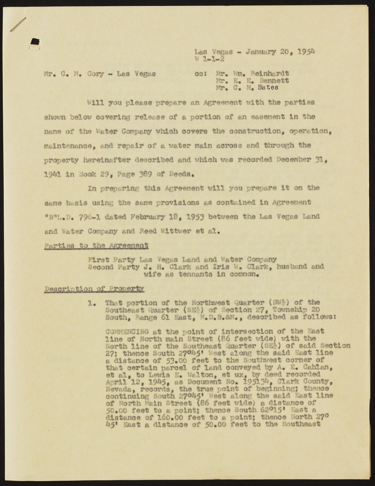
L&t Ysgas » January 20* 193& i 2*1*2 Hr. C* If* ©cry - Las teg&e eat Mr* w«. 8«inli&rdt Hr. s« I. Bennett Mr* C« K Bates Will you pleas# prepare an Agreement with the parties shown below covering release of a portion of an easement in the nan# of the te&ter Compaq which cover® the construction# operation, aaintenanoe* and repair of a water ra&ln across and through the property hereinafter described and which wee recorded beceraber 31# 19hl in 3e*fe 29# Fag# 389 of Peed®* In preparing this Agreement will you prepare it cm the sane b&st* using the ease provisions as contained in Agreement *K*I»&* 796*1 dated February 18# 1953 between the ha®. Vseos Land and. .fc&ter 0<wapany and Heed bittwer et cl, Parties..to„..,the..,..Mr.emtiLt First Party Um Yegas Land and later Cos&anar Second Party J* 1* Cl&rh and Iris b. dart, husband and wife as tennants in mtmm* Saaorlntlon of. Property 1* that portion of the horthwest Quarter (88-1) of the Southeast Quarter (sk|) of Section 2?* Township 2© South* Sang# 6t last, T'.a.S*Mh, described m follows! ComsNClN© at the point of intersection of the East line of north main Street (86 feet wide) with the Berth line of the Southeast Quarter (®S|) of said section 27j thence South 2?°S5» west ©long the said Ssst line & distance of 53*0© feet to the Southwest comer of that certain parcel of land conveyed by A* S* Osh!an, et al# to Lewis S* Walton, et ux, « deed recoiled April 12# 19h5* as"Document m* 195131*, Glsrte County, liev&da, records, the true point of beginning! thanes continuing South 2^5* West along the said £ast line of north Hsin Street X&6 feet wide) m distance of 50*go feet to a point} thence South 62®15* Sa®t a distance of 260*00 feet to a point} thence north 27® 051 East a distance of 50*00 feet to the Southeast

