Copyright & Fair-use Agreement
UNLV Special Collections provides copies of materials to facilitate private study, scholarship, or research. Material not in the public domain may be used according to fair use of copyrighted materials as defined by copyright law. Please cite us.
Please note that UNLV may not own the copyright to these materials and cannot provide permission to publish or distribute materials when UNLV is not the copyright holder. The user is solely responsible for determining the copyright status of materials and obtaining permission to use material from the copyright holder and for determining whether any permissions relating to any other rights are necessary for the intended use, and for obtaining all required permissions beyond that allowed by fair use.
Read more about our reproduction and use policy.
I agree.Information
Digital ID
Permalink
Details
More Info
Rights
Digital Provenance
Publisher
Transcription
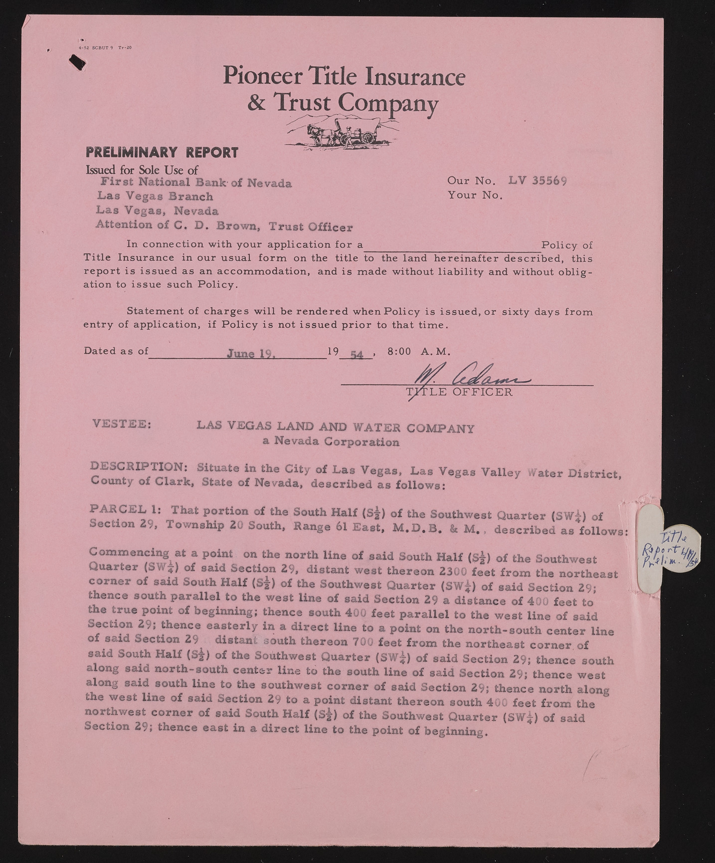
4-52 SCBUT 9 T r-20 m Pioneer Title Insurance & Trust Company PRELIMINARY REPORT Issued for Sole Use o f First National Bank of Nevada Las Vegas Branch Las Vegas, Nevada Attention of C. D. Brown, Trust Officer O ur N o . LV 35569 Y o u r N o . In connection w ith your ap p lication fo r a P o lic y of T itle Insurance in our usual fo r m on the title to the land h e re in a fte r d escrib ed , this r e p o rt is issu ed as an accom m odation , and is m ade without lia b ility and without o b lig ation to issu e such P o lic y . Statem ent of ch a rges w ill be ren d ere d when P o lic y is issu ed, o r s ix ty days fro m en try o f ap p lication , i f P o lic y is not issu ed p r io r to that tim e. DESCRIPTION: Situate in the City of Las Vegas, Las Vegas Valley Water District, County of Clark, State of Nevada, described as follows: PA R C E L 1: That portion of the South Half (S|) of the Southwest Quarter (SW^) of Section 29, Township 20 South, Range 61 East, M .D .B . & M. , described as follows Commencing at a point on the north line of said South Half (s|) of the Southwest Quarter (SW?) of said Section 29, distant west thereon 2300 feet from the northeast corner of said South Half (S j) of the Southwest Quarter (SW|) of said Section 29; thence south parallel to the west line of said Section 29 a distance of 400 feet to the true point of beginning; thence south 400 feet parallel to the west line of said Section 29; thence easterly in a direct line to a point on the north-south center line of said Section 29 distant south thereon 700 feet from the northeast corner of said South Half (S|) of the Southwest Quarter (SW?) of said Section 29; thence south along said north-south center line to the south line of said Section 29; thence west along said south line to the southwest corner of said Section 29; thence north along the west line of said Section 29 to a point distant thereon south 400 feet from the northwest corner of said South Half (S j) of the Southwest Quarter (SW^) of said Section 29; thence east in a direct line to the point of beginning. Dated as of June 19. 19 cut . 8:00 A . M . VESTEE: LAS VEGAS LAND AND WATER COMPANY a Nevada Corporation

