Copyright & Fair-use Agreement
UNLV Special Collections provides copies of materials to facilitate private study, scholarship, or research. Material not in the public domain may be used according to fair use of copyrighted materials as defined by copyright law. Please cite us.
Please note that UNLV may not own the copyright to these materials and cannot provide permission to publish or distribute materials when UNLV is not the copyright holder. The user is solely responsible for determining the copyright status of materials and obtaining permission to use material from the copyright holder and for determining whether any permissions relating to any other rights are necessary for the intended use, and for obtaining all required permissions beyond that allowed by fair use.
Read more about our reproduction and use policy.
I agree.Information
Digital ID
Permalink
Details
More Info
Rights
Digital Provenance
Publisher
Transcription
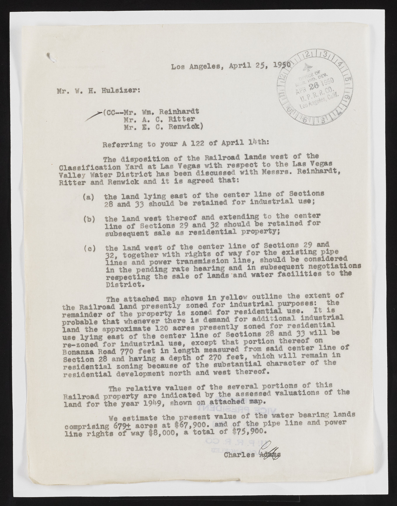
LOS Angeles, April 25, Mr. W. H. Huleizer: H : A & st . j-(CC— M r. Wm. Reinhardt ^ Mr. A. C. Ritter Mr. E. C. Renwick) Referring to your A 122 of April l^th: The disposition of the Railroad lands west of the Classification Yard at Las Vegas with respect to the vegae Valley Water District has been discussed with Messrs. Keinnaru*, Ritter and Renwick and it is agreed that: (a) the land lying east of the center line of Sections 28 and 33 should be retained for industrial use; (b) the land west thereof and extending to the center line of Sections 29 and 32 should be retained for subsequent sale as residential property; (o) the land west of the center line of Sections 29 and 32, together with rights of way for the existing P*P® lines and power transmission line, should be considered. ^ in the pending rate hearing and in subsequent negotiations respecting the sale of lands and water facilities to the District. The attached map shows in yellow outline the extent of the Railroad land presently zoned for industrial purposes: he remainder of the property is zoned for residential use. it is probable that whenever there is demand for addl£lonal- S i S i n l * ' land the approximate 120 acres presently L use lying east of the center line of Sections 28 and 33 ***1 be re-zoned for Industrial use, except that portion thereof on Bonanza Road 770 feet in length measured from said^ of Section 28 and having a depth of 270 feet, which will remain 1 residential zoning because of the substantial character of the residential development north and west thereof. The relative values of the several P®rticns Railroad property are indicated by the assessed valuations of t land for the year 19^9, shown on attached map. We estimate the present value of the water bearing lands comprising 67% acres at $67,900. and of the pipe line ana power line rights of way $8,000, a total of $75,900. Charles

