Copyright & Fair-use Agreement
UNLV Special Collections provides copies of materials to facilitate private study, scholarship, or research. Material not in the public domain may be used according to fair use of copyrighted materials as defined by copyright law. Please cite us.
Please note that UNLV may not own the copyright to these materials and cannot provide permission to publish or distribute materials when UNLV is not the copyright holder. The user is solely responsible for determining the copyright status of materials and obtaining permission to use material from the copyright holder and for determining whether any permissions relating to any other rights are necessary for the intended use, and for obtaining all required permissions beyond that allowed by fair use.
Read more about our reproduction and use policy.
I agree.Information
Digital ID
Permalink
Details
Member of
More Info
Rights
Digital Provenance
Publisher
Transcription
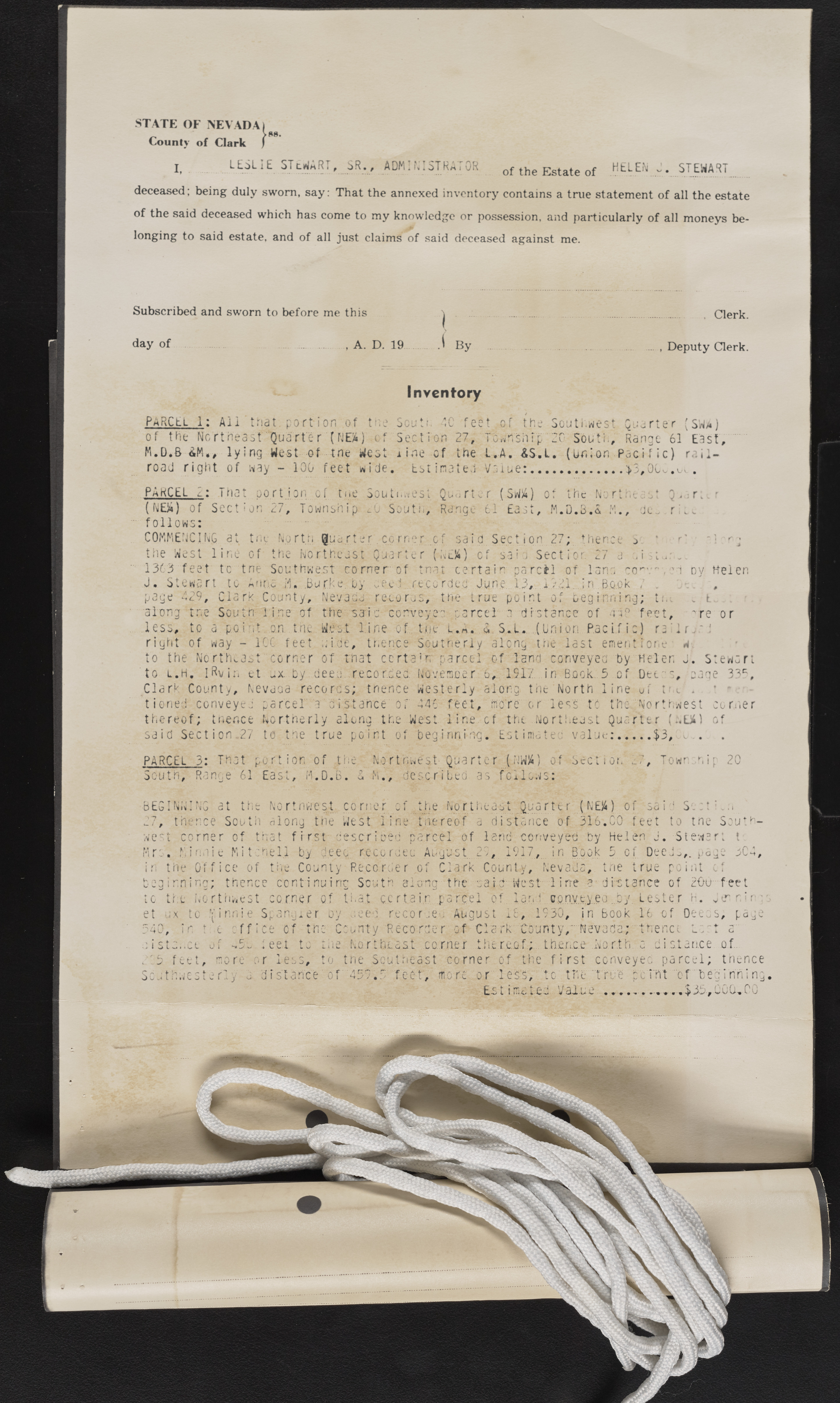
ST A T E OF NEVADA County of Clark ns. I, ....... ^S T E W hRT»_SR•# ADMINISTRATOR o f the Estate o f HELEN J . STEWART deceased; being duly sworn, say: That the annexed inventory contains a true statement o f all the estate o f the said deceased which has come to my knowledge or possession, and particularly o f all moneys be-longing to said estate, and o f all just claims o f said deceased against me. Subscribed and sworn to before me this . Clerk. day o f , A. D. 19 ..., Deputy Clerk. Inventory PARCEL l : All that, port ion of the Scut:. 40 feet of the Southwest Quarter (SWA) of the Northeast Quarter (NEa ) cf Section 27, Township 20 South, Range 61 East, M.D.ft AM.# ly inc[ Mcsi of ? tne oi 1 1^c • of the L• A• ^5• t»• | ? -on • Pjcif ic| r<• i^• road right of way - 100 feet wide, Es>i imated Value:.......................... >3,0C„.^. PAKCEL__ i ha portion of tne Southwest Quarter ( SW!4) or the Northeast 0 of Section 27, Township .0 South, Range 61 East, M.D.3.& M., de j r r : follow c • COMMENCING at tne North Quarter corner c the West line of the Northeast Quarter ( 1363 feet tc tne Southwest corner of tna J . Stewart to arinc . .Bur!-e. Uy voc 1 repo page 429, Clark County, Nevada reooras, along tr.e South line of the said com;eye less, to a point on the West line of. t.ue right of way - TOC feet aide, tr.ence Sou to the Northeast corner of that c c rt a 1 tv to l . h. IRv in et ux. by. deed, recorded. Nov Clark County, Nevada records; thence Wes tioned conveyed parcel' a distance Of 446 thereof; thence Northerly along the West 3id Sect ion.27 to tne true point of beg sa i rtu I•N; fUS/L4 J^ rU fI £> V n S* L. Sa S e c t sa i t certain p rded June 1 the true po d parcel L rn n m Ck therly alon parcel of 1 ember. 6,. 19 terly along feet, more line cf th inning. Est 07 then e CJ L U •,el dv Helen t n I on< ? | S e c tio n 27 a rcil of lana cor 3,..1.721.in.Book ; i n’t of beginning; distance of 4 i P feet, "re or (Union Pacific) r a : 1 r , : : g the last eirient ione w and conveyed by Helen j . Stewart 17 in Book. 5 of Dec: ", cage 33c , the North line of t m ' . • - - or less to the Northwest cornier t Northeast Quarter (:.EA) of i la tec value:......... $3, do... PARCEL 3: That portion of the Northwest-Quarter (NWX) of South, Range 61 East, H.D.B. a M., described as fellows: S e c t i o n ' / own snip 20 -BEGINNING at the Nortnwest corner of the Northeast Quarter (NE)4) of saio S;. : t : ' 27, thence South along the West line-thereof a distance of 316.CO feet to tne Southwest corner of that f ir s t described parcel of lend conveyed by Helen J. Stewart t Mrs. Tin,lit Mitchell by deed recorded August 27, 1917, in Book 5 of Deeds, page uC4, in the Office of the County Recorder of Clark County, Nevada, tne true point cf beginning; thence continuing South along the said-West line a distance of 200 feet tc the Northwest corner of that certain parcel of. Ia n i conveyeo...by. Lester h, Jm nin: s et ux tc ff i nni e Sp.angler by ueed recordeu August 15, 1930, in book 16 of Deeds; page 340, in t;.e o f f i c e of tnc County Recorder o f Clark County, Nevada; thence l ~: t a • i' 4i ^c tL ^^ I i wa nE \ rS ^, 5^ -ii feel to tiie. Northeast corner thereof.;., thence North 223 feet, mo re or less, to tne Southeast corner of the f i r s t conveyed parcel; thence s s i y a a distance of. s o u t h w e s t e r l y a distance o f 4 5 9 . 3 feet, more o r l e s s , t o the " t r u e p o i n t o f ‘beginning. E-S t i V3JLui2 ? #•$35*UuO-.00 — j*; 9 H’lna L V . *-V> 30

