Copyright & Fair-use Agreement
UNLV Special Collections provides copies of materials to facilitate private study, scholarship, or research. Material not in the public domain may be used according to fair use of copyrighted materials as defined by copyright law. Please cite us.
Please note that UNLV may not own the copyright to these materials and cannot provide permission to publish or distribute materials when UNLV is not the copyright holder. The user is solely responsible for determining the copyright status of materials and obtaining permission to use material from the copyright holder and for determining whether any permissions relating to any other rights are necessary for the intended use, and for obtaining all required permissions beyond that allowed by fair use.
Read more about our reproduction and use policy.
I agree.Information
Digital ID
Permalink
Details
More Info
Rights
Digital Provenance
Publisher
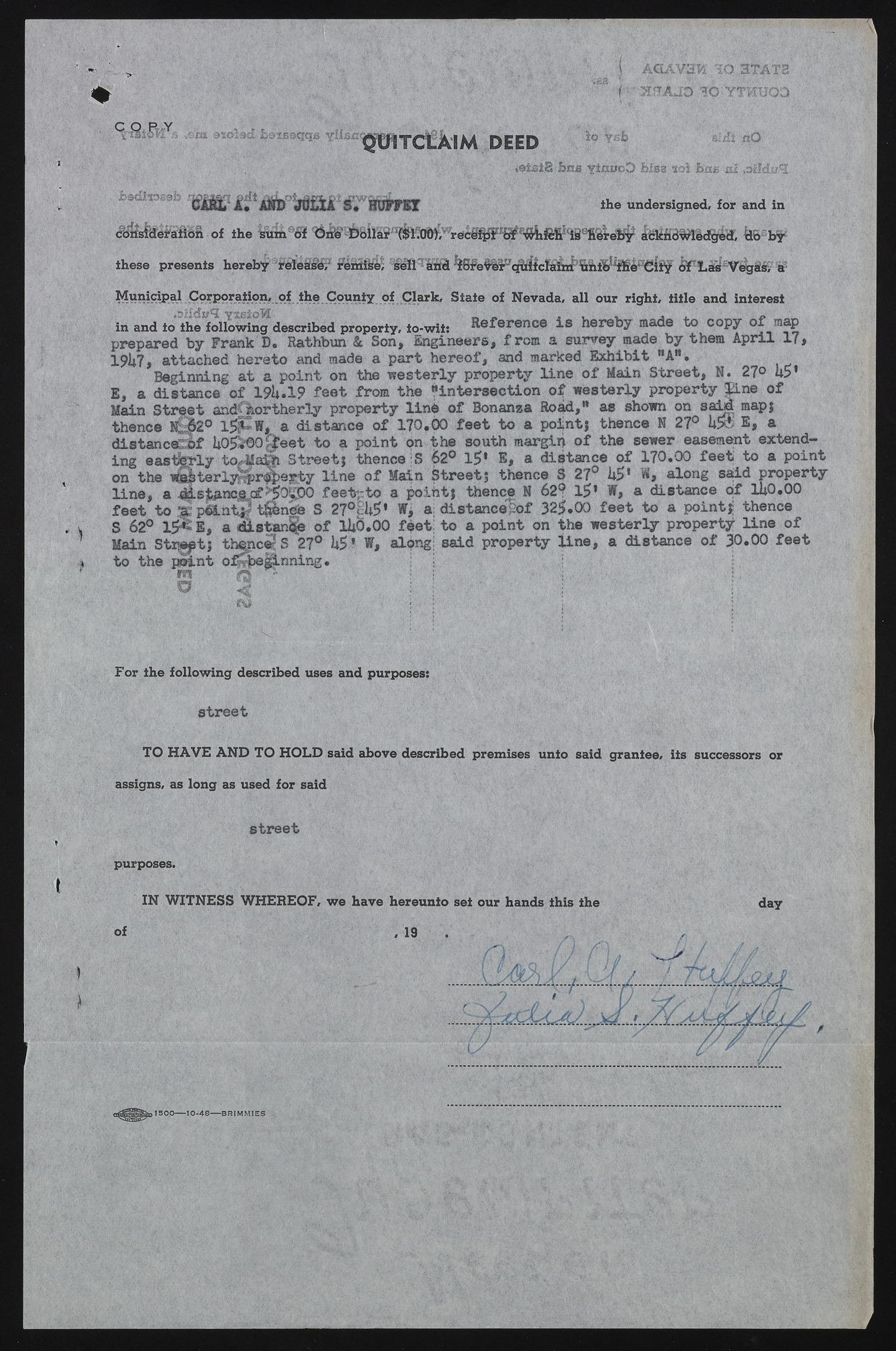
Transcription
v ?, AOAV3H 3Q STATS M H 0 A JO S O YTMUQD ^ m rd tk \s \ d eed slzfi nO i8 has yiniieD blss nai bnBm.aiM c a r l a ;! At* jclia iFfflfam ihe undersigned, for and in Municipal Corporation, of ihe County of Clark, State of Nevada, all our right, title and interest . Reference is hereby made to copy of ms prepared by Frank D. Rathbun & Son, Engineers, ] map >rs, from a survey made by them April 1? 19k7, attached hereto and made a part hereof, and marked Exhibit nAB. Beginning at a point on the westerly property line of Main Street, N. 27° US* E, a distance of 19i*.l? feet from the “intersection o£ westerly property line of Main Street andfftor therly property line of Bonanza Road,tt as shown on said map} thence N^2° 1$P»W, a distance of 170.00 feet to a point} thence N 27° US® E, a distanced^ UO$%©o££eet to a point on the south margin of the sewer easement extending easterly to^aSi Street} thence S 62° 1$’ E, a distance of 170.00 feet to a point on the terly^rfpe^ty line of Main Street; thence S 27° U5* if, along said property line, a d|.stanc£cf %olf>© feet;:to a point; thence N 62s? 1$* W, a distance of lUO.OO feet to M pfitntS S 27°§U$* fi a: distancegof 32$.00 feet to a point}; thence t S 62° 1$*SE, a distance of UiO.OO feet; to a point on the westerly property line of Mai-n Strteft; thence; S 27° U5 * W, along; said property line, a distance of 30.00 feet 4 to the paint * • mw o%fee g‘ %i nning. ! ! For the following described uses and purposes: street TO HAVE AND TO HOLD said above described premises unto said grantee, its successors or assigns, as long as used for said street purposes. IN WITNESS WHEREOF, we have hereunto set our bands this the day of , 19 1 50 0 ------1 0 -4 8 ------B R IM M IE S

