Copyright & Fair-use Agreement
UNLV Special Collections provides copies of materials to facilitate private study, scholarship, or research. Material not in the public domain may be used according to fair use of copyrighted materials as defined by copyright law. Please cite us.
Please note that UNLV may not own the copyright to these materials and cannot provide permission to publish or distribute materials when UNLV is not the copyright holder. The user is solely responsible for determining the copyright status of materials and obtaining permission to use material from the copyright holder and for determining whether any permissions relating to any other rights are necessary for the intended use, and for obtaining all required permissions beyond that allowed by fair use.
Read more about our reproduction and use policy.
I agree.Information
Digital ID
Permalink
Details
Member of
More Info
Rights
Digital Provenance
Publisher
Transcription
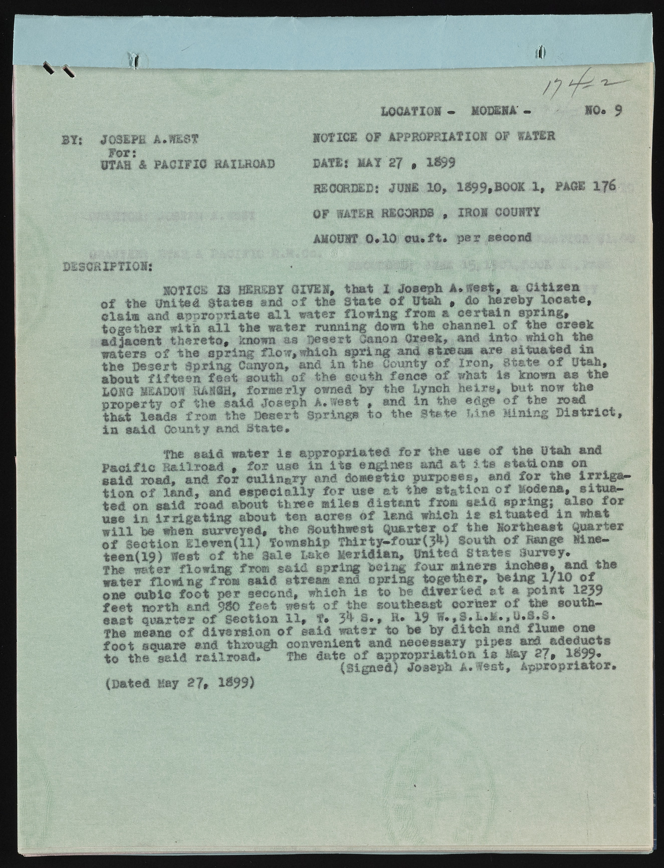
V \ / LOCATION - MODENA' NO. p 3Yj JOSEPH A.WEST For: UTAH A PACIFIC RAILROAD NOTICE OF APPROPRIATION OF WATER DATE{ MAY 27 * 1*99 RECORDED: JUNE 10, 1 $99,BOOK. X, PAGE 1?6 OF WATER RECORDS , IRON COUNTY AMOUNT 0.10? c u . f t . p e r second DESCRIPTION! NOTICE 13 HEREBY GIVEN, th at I Joseph A. West, a C lt is e a o f the united States and o f the State o f Utah , do hereby lo c a t e , ol&im and a p p ro p ria te a l l water flo w in g from a c e rta in sp rin g , to geth er w ith a l l the w ater running down the channel o f the creek ad jacen t th e re to , known as Desert Canon Creek, and in to which the w aters o f the s p rin g flo w ,w h ich s p rin g and stream a re situ a te d in the D esert S p rin g Canyon, and in the County o f Iro n , State o f Utah, about f i f t e e n fe a t south o f the south fence o f what is known a s the LONG MEADOW RANCH, form erly owned by the Lynch h e ir s , but now the property o f the s a id Joseph A. west , and in the edge o f the road th&t lead s from the D esert Springs to the State Line Mining D i s t r i c t , in s a id County and State* The s a id w ater I s ap p ro p riated f o r the use o f the Utah and P a c i f ic R a ilro a d , fo r use in i t s en gin es and a t i t s s t a t io n * on s a id road, and f o r c u lin a ry and domestic purposes, and fo r the i r r i g a t io n o f la n d , and e s p e c ia lly f o r use a t the s ta tio n o f Modena, situ a^ ted on sa id road about three m iles d is ta n t fro® s a id sp rin g ; a ls o f o r use in i r r i g a t i n g about ten acres o f lan d which i s situ a te d in what w i l l be when surveyed, the Southwest Q uarter o f the Northeast Quarter o f se c tio n E leven (11) Township T h ir t y -f o u r t h ) South o f Range Ninet e e n ! ^ ) West o f the Sale Lake M eridian, United States Survey. The water flo w in g from s a id sp rin g bein g fo u r miners inches, and the w ater flo w in g from sa id stream end sp rin g togeth er, b e in g l / W o f one cubic fo o t p er second, which is to be d iv e rte d a t a p oin t 1259 fe e t north and 980 fe e t west o f the southeast corner o f the southe a st q u arter o f Section 11, f . 5% S . , R. 19 W .,S .L .M .,U .S .3 . The means o f d iv e rs io n o f s a id w ater to be by d itc h and flume one (D ated Hay 27, 1N99)

