Copyright & Fair-use Agreement
UNLV Special Collections provides copies of materials to facilitate private study, scholarship, or research. Material not in the public domain may be used according to fair use of copyrighted materials as defined by copyright law. Please cite us.
Please note that UNLV may not own the copyright to these materials and cannot provide permission to publish or distribute materials when UNLV is not the copyright holder. The user is solely responsible for determining the copyright status of materials and obtaining permission to use material from the copyright holder and for determining whether any permissions relating to any other rights are necessary for the intended use, and for obtaining all required permissions beyond that allowed by fair use.
Read more about our reproduction and use policy.
I agree.Information
Digital ID
Permalink
Details
Member of
More Info
Rights
Digital Provenance
Publisher
Transcription
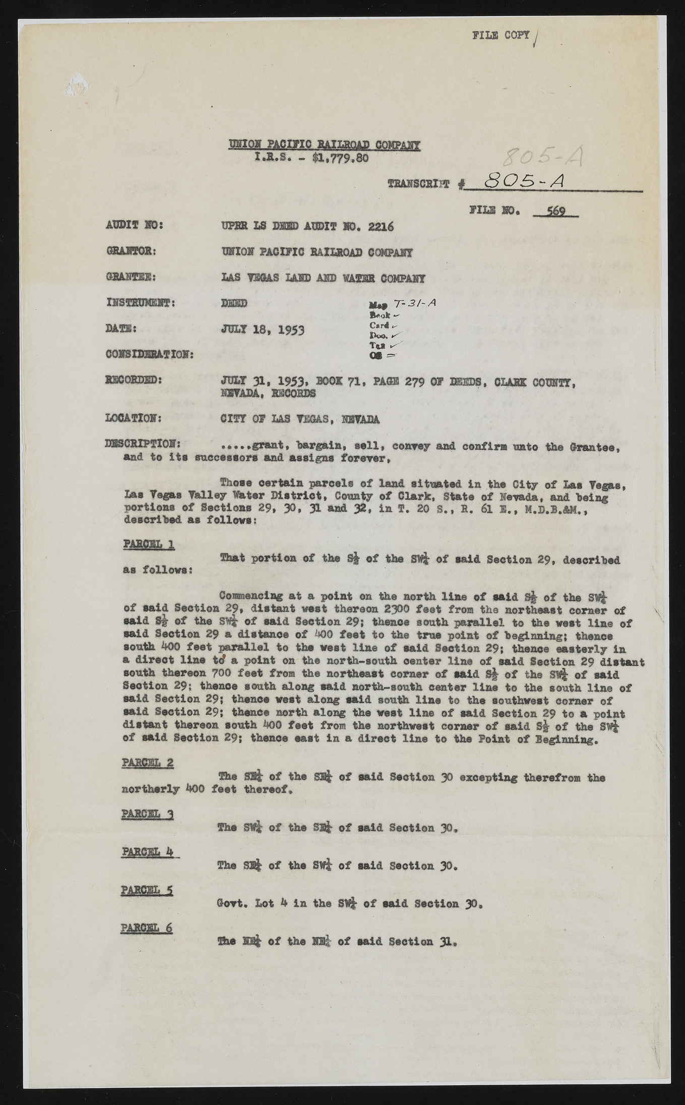
FILS COPT / CTHQ» PACIFIC RAILROAD COMPANY I.R.S. - $1,779,80 TRANSCRIPT » 8 OS - A AUDIT VO: GRANTOR: GRANTEE: INSTEUWEHT: M U : C0MBIDB8ATI0I: RECORDED: LOCATION: FILSHO. DPHH LS D2EBD AUDIT 10. 2216 UNION1 PACIFIC RAILROAD COMPART LAS TSGAS LAID ABB WATER COMPART DEED u*9 T - 3 / - A B^ok — JULY 18, 1953 £ £ > Tfc* ^ Ot |j •H3LY 31, 1953* BOOK 71. PAGE 279 OF DEEDS, CLARK COURTT, NEVADA, RECORDS CITY OF LAS TEGAS, NEVADA DESCRIPTION: grant, ‘bargain, sail, convey and confirm unto the Grantee, and to its successors and assigns forever, Those certain parcels of land situated in the City of Las Tegas, Las Tegas Talley Thter District, County of Clark, State of Nevada, and being portions of Sections 29, 30, 31 and 32, in f. 20 S., R. 6l 5., M.D.l.&M., described as follows: PARCEL 1 as follows: That portion of the S| of the Sift of said Section 29, described Commencing at a point on the north line of said S§ of the Sift of said Section 29, distant west thereon 2300 feet from the northeast comer of •aid Sg- of the Swt of said Section 29; thence south parallel to the west line of said Seotion 29 a distance of 400 feet to the true point of beginning; thence south 400 feet parallel to the west line of said Seotion 29; thence easterly in a direct line tc? a point on the north-south oenter line of said Seotion 29 distant south thareon 700 feat from the northeast corner of said Sj of the of maid Seotion 29; thence south along said north-south oenter line to the south line of said Section 29; thence west along said south line to the southwest corner of •aid Section 29; thence north along the west line of said Section 29 to a point distant thereon south 400 feet from the northwest corner of said St of the Swt of said Seotion 29; thenoe east in a direct line to the Point of Beginning. PARCEL 2 The SJS* of the sat of said Seotion JO excepting therefrom the northerly 400 foot thereof, PAnem. 3 The SVt of the Sat of said Seotion 30, PARCEL 4 The SB* of the SVt of said Seotion 30. PARCEL 5 Govt. Lot 4 in the SRt of said Section 30, PARCEL 6 The REt of the NHt of said Seotion 31.

