Copyright & Fair-use Agreement
UNLV Special Collections provides copies of materials to facilitate private study, scholarship, or research. Material not in the public domain may be used according to fair use of copyrighted materials as defined by copyright law. Please cite us.
Please note that UNLV may not own the copyright to these materials and cannot provide permission to publish or distribute materials when UNLV is not the copyright holder. The user is solely responsible for determining the copyright status of materials and obtaining permission to use material from the copyright holder and for determining whether any permissions relating to any other rights are necessary for the intended use, and for obtaining all required permissions beyond that allowed by fair use.
Read more about our reproduction and use policy.
I agree.Information
Digital ID
Permalink
Details
Member of
More Info
Rights
Digital Provenance
Publisher
Transcription
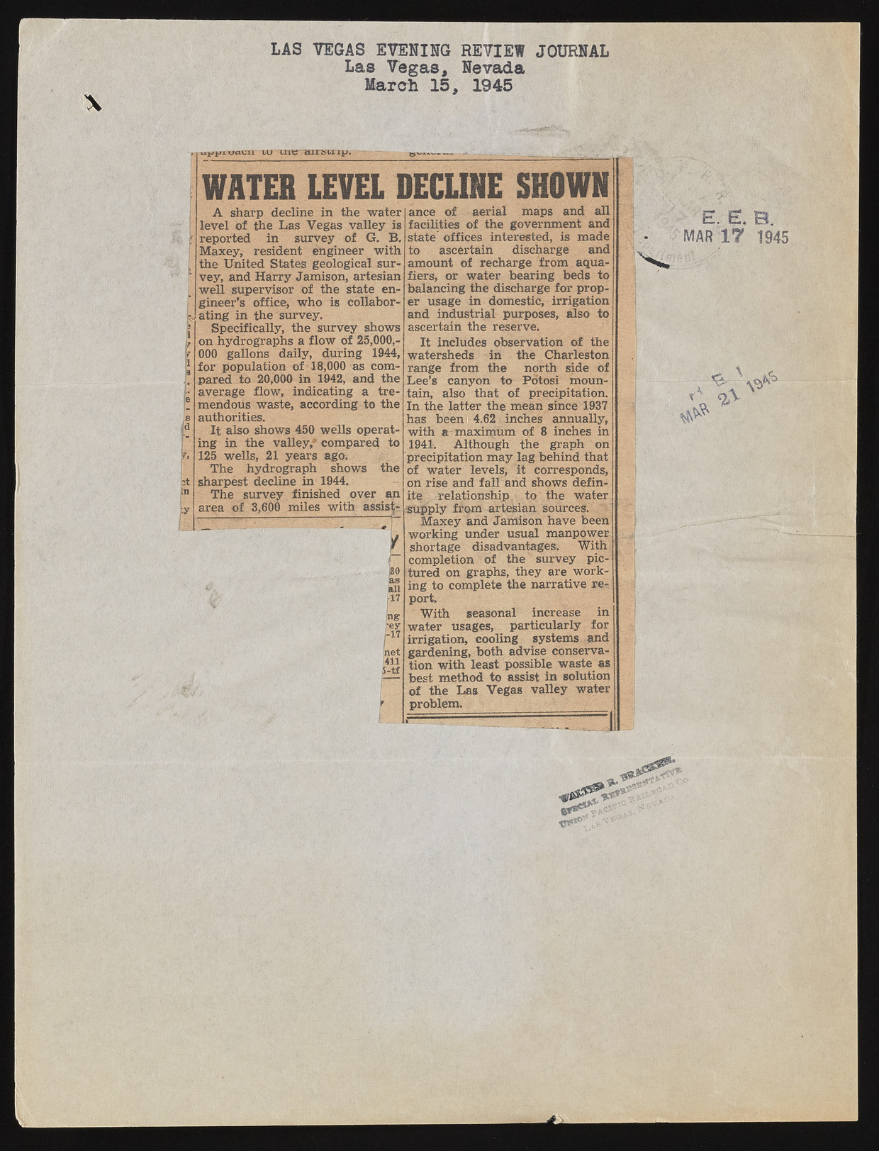
LAS VEGAS EVENING REVIEW JOURNAL Las Vegas, Nevada March 15, 1945 wacn lu iiie airstrip. WATER LEVEL DECLINE SHOWN A sharp decline in the water level of the Las Vegas valley is reported in survey of G. B. Maxey, resident engineer with the United States geological survey, and Harry Jamison, artesian well supervisor of the state engineer’s office, who is collaborating in the survey. Specifically, the survey shows on hydrographs a flow of 25,000,- 000 gallons daily, during 1944, for population of 18,000 as compared to 20,000 in 1942, and the average flow, indicating a tremendous waste, according to the authorities. It also shows 450 wells operating in the valley,*’ compared to 125 wells, 21 years ago. The hydrograph shows the sharpest decline in 1944. The survey finished over an area of 3,600 miles with assists m bet Till 5-tf ance of aerial maps and all facilities of the government and state’ offices interested, is made to ascertain discharge and amount of recharge from aqua-fiers, or water bearing beds to balancing the discharge for proper usage in domestic, irrigation and industrial purposes, also to ascertain the reserve. It includes observation of the watersheds in the Charleston range from the north side of Lee’s canyon to Potosi mountain, also that of precipitation. In the latter the mean since 1937 has been i 4.62 * inches annually, with a-maximum of 8 inches in 1941*. Although the graph on precipitation may lag behind that of water levels, it corresponds, on rise and fair and shows definite relationship to the water supply from artesian sources. Maxey and Jamison have been working under usual manpower, shortage disadvantages. With completion of the survey pictured on graphs, they are working to complete the narrative report. With seasonal increase in water usages, particularly for irrigation, cooling systems and gardening, both advise conservation with least possible waste as best method to assist in solution of the Las Vegas valley water problem. ?________ P P R MAR 17 1945 V * ^V

