Copyright & Fair-use Agreement
UNLV Special Collections provides copies of materials to facilitate private study, scholarship, or research. Material not in the public domain may be used according to fair use of copyrighted materials as defined by copyright law. Please cite us.
Please note that UNLV may not own the copyright to these materials and cannot provide permission to publish or distribute materials when UNLV is not the copyright holder. The user is solely responsible for determining the copyright status of materials and obtaining permission to use material from the copyright holder and for determining whether any permissions relating to any other rights are necessary for the intended use, and for obtaining all required permissions beyond that allowed by fair use.
Read more about our reproduction and use policy.
I agree.Information
Digital ID
Permalink
Details
Member of
More Info
Rights
Digital Provenance
Publisher
Transcription
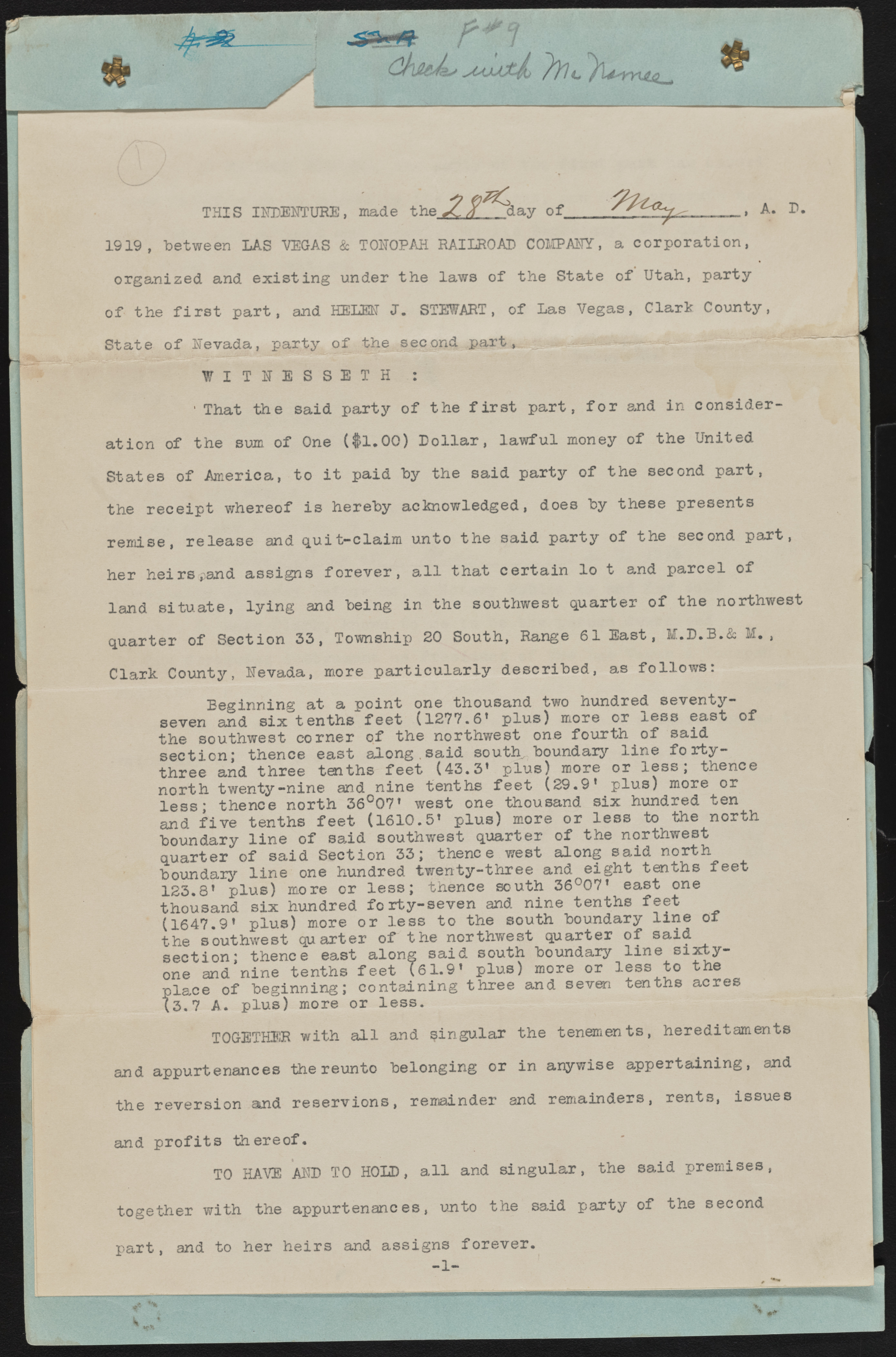
THIS INDENTURE, made the.11 day of A. D. 1919, between LAS VEGAS & TONOPAH RAILROAD COMPANY, a corporation, ? organized and e x istin g under the laws of the State of Utah, party o f the f i r s t p a rt, and HELEN J. STEWART, of Las Vegas, Clark County, State of Nevada, party of the second p a r t , p W I T N E S S E T H : ' That the said party of the f i r s t p a rt, f o r and in consideration of the sum of One ($1.00) D o lla r , la w fu l money of the United States of America, to i t paid by the said party of the second p a rt, the receipt whereof is hereby acknowledged, does by these presents remise, release and q u it-c la im unto the said party of the second p art, her h eirs,an d assigns fo r e v e r , a l l that certain lo t and p arcel of land situ a te , ly in g and being in the southwest quarter o f the northwest quarter of Section 33, Township 20 South, Range 61 East, M.D.B.& M ., Clark County, Nevada, more p a rtic u la rly described, as fo llo w s : Beginning at a point one thousand two hundred seventy-seven and six tenths fe e t (1277.6’ p lu s ) more or le s s east of the southwest corner of the northwest one fourth o f said section; thence east along, said souths boundary lin e fo r t y - three and three tenths fe et (43.3* p lu s ) more or le s s ; thence north twenty-nine and nine tenths fe e t (2 9 .9 1 p lu s) more or le s s ; thence north 36°07’ west one thousand six hundred ten and fiv e tenths fe e t (1610.5’ p lu s) more or le s s to the north boundary lin e of said southwest quarter of the northwest quarter of said Section 33; thence west along sa id north boundary lin e one hundred twenty-three and eight tenths fe e t 123.8’ p lu s) more or le s s ; thence south 36°07’ east one thousand six hundred fo rty -sev en and nine tenths feet (1647.9’ p lu s) more or le s s to the south boundary lin e of the southwest quarter of the northwest quarter o f said section; thence east along sa id south boundary lin e s ix ty - one and nine tenths fe e t 161.9 f p lu s) more or less to the place of beginning; containing three and seven tenths acres (3.7 A. p lu s) more or le s s . TOGETHER with a l l and singular the tenements, hereditaments and appurtenances the reunto belonging or in anywise appertaining, and the reversion and reservion s, remainder and remainders, rents, issues and p r o fit s thereof. TO HAVE AND TO HOLD, a l l and sin gu la r, the said premises, together with the appurtenances, unto the said party of the second p a rt, and to her h e irs and assigns forever. - 1 -

