Skip to main content
Main navigation
Finding Aids
Digital Projects
African American Experience in Las Vegas
Charles Saladino Landscape Architecture Collection
Culinary Union Photograph Collection
Dino at the Sands
Dreaming the Skyline
Entertainment
Historic Landscape of Nevada
Hoover Dam
Jamey Stillings
Menus: The Art of Dining
Nevada Test Site Oral History Project
Newspapers
Oral Histories Collection
Photograph Collections
Rebel Yell Newspaper
Showgirls
Southern Nevada: The Boomtown Years 1900-1925
Southern Nevada History in Maps
Southern Nevada Jewish Heritage Project
UNLV CSUN Records
Union Pacific Railroad Water Documents
Walking Box Ranch Collection
Welcome Home Howard
About
Request Images
Help
Provide Feedback
Special Collections Home
Search the Special Collections and Archives Portal
Search
Search
Breadcrumb
Special Collections and Archives Portal
public utility maps
Maps that display specific public infrastructure.
Authority Sources
AAT
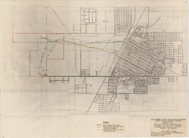
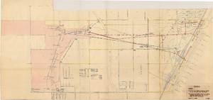
Map to accompany agreement with Las Vegas Land and Water Company covering furnishing of water by UPRRCo. to LVL&WCo. at Las Vegas, Nevada, October 4, 1950
Image
View
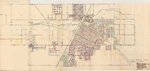
Map of Las Vegas Valley Water District, April 16, 1953
Image
View
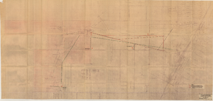
Map showing location of proposed water line to be installed along Los Angeles & Salt Lake Railroad Co. Track No. 8, Las Vegas, Nevada, May 1, 1931
Image
View
Map showing location of proposed water lines serving Industrial Tract No. 1, Las Vegas Nevada, March 21, 1931
Image
View
Map showing possible industrial users' connections to railroad pipelines in Las Vegas Nevada, circa 1930-1931
Image
View
Map showing possible industrial users' connections to railroad pipelines in Las Vegas, Nevada, December 4, 1930
Image
View
Map showing proposed new 12" well and pipe line changes at Water Springs, Las Vegas, Nevada, circa 1920
Image
View
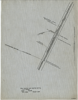
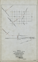
Map showing water pipeline serving H. C. Wheeler, Arden, Nevada, November 1929
Image
View
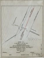
Map to accompany water contract, Enterprise School District, Arden, Nevada, September 1919
Image
View
Map showing water pipeline in Arden, Nevada, May 4, 1913
Image
View
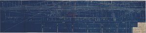
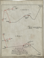
Sketch of plan and profile of present and proposed pipes and tanks and reservoirs at Sloan, Erie and Jean, Nevada, circa 1910s-1920s
Image
View
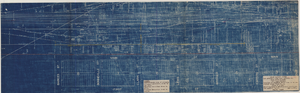
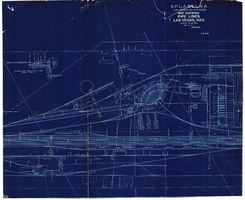
Blueprint map showing proposed water pipeline from Big Spring to Las Vegas, Nevada, January 24, 1911
Image
View
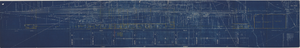
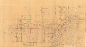
Map of Las Vegas showing areas owned by the Union Pacific Railroad Company, water pipes and other water utilities, circa 1942
Image
View
Map showing water pipelines, Las Vegas, Nevada, January 15, 1914
Image
View
Map of well locations, Las Vegas Valley, Nevada, 1975
Image
View
Map showing location of water-bearing lands to be sold to the Las Vegas Valley Water District, March 1, 1953
Image
View
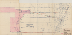
Map showing various facilities of the Las Vegas Land and Water Company, March 1, 1953
Image
View
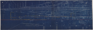
Map showing proposed relocation or removal of existing water transmission mains and power lines at Las Vegas, Nevada, June 3, 1952
Image
View
Pagination
Current page
1
Page
2
Next page
››
Last page
Last »