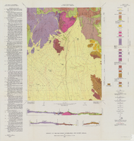
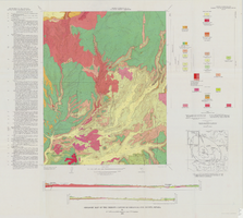
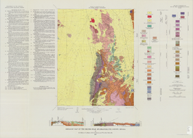
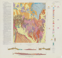
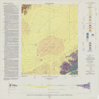
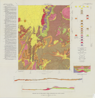
quadrangle maps
Maps, as those published by the United States Geological Survey, which show tracts of a country on a series of sheets and according to a specified scale.
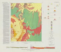
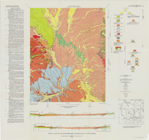


Maps, as those published by the United States Geological Survey, which show tracts of a country on a series of sheets and according to a specified scale.