Skip to main content
Main navigation
Finding Aids
Digital Projects
African American Experience in Las Vegas
Charles Saladino Landscape Architecture Collection
Culinary Union Photograph Collection
Dino at the Sands
Dreaming the Skyline
Entertainment
Historic Landscape of Nevada
Hoover Dam
Jamey Stillings
Menus: The Art of Dining
Nevada Test Site Oral History Project
Newspapers
Oral Histories Collection
Photograph Collections
Rebel Yell Newspaper
Showgirls
Southern Nevada: The Boomtown Years 1900-1925
Southern Nevada History in Maps
Southern Nevada Jewish Heritage Project
UNLV CSUN Records
Union Pacific Railroad Water Documents
Walking Box Ranch Collection
Welcome Home Howard
About
Request Images
Help
Provide Feedback
Special Collections Home
Search the Special Collections and Archives Portal
Search
Search
Breadcrumb
Special Collections and Archives Portal
thematic maps
Maps designed primarily to meet specific requirements.
Authority Sources
AAT
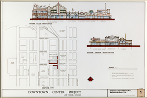
Architectural drawing, downtown center project (Las Vegas), location plan and interim façade modifications, July 10, 1987
Image
View
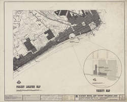
Architectural drawing of the Playboy Hotel and Casino (Atlantic City), master plan, project location map, April 5, 1979
Image
View
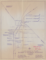
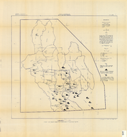
Map of work locations executed by Rissman and Rissman and Associates, Nevada, December 1, 1968
Image
View
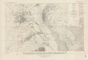
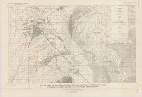
Map of part of Las Vegas Valley, Nevada, showing approximate area and areal densities of phreatophytes and areas in cultivation in 1912
Image
View
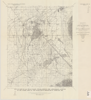
Map of part of Las Vegas Valley, Nevada, showing approximate area of phreatophytes before ground-water development
Image
View
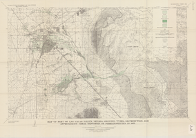
Map of part of Las Vegas Valley, Nevada, showing types, distribution, and approximate areal densities of phreatophytes in 1955
Image
View
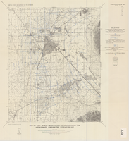
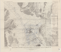
Map of part of Las Vegas Valley, Nevada, showing the approximate altitude of the water table in the near-surface reservoir in February 1956
Image
View
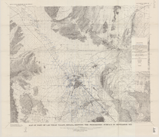
Map of part of Las Vegas Valley, Nevada, showing the approximate piezometric surface in 1912
Image
View
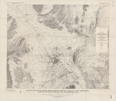
Map of part of Las Vegas Valley, Nevada, showing changes in the piezometric surface between February 1944 and February 1956
Image
View
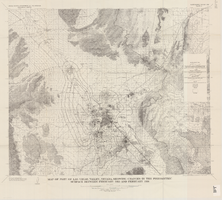
Map of part of Las Vegas Valley, Nevada, showing changes in the piezometric surface between February 1955 and February 1956
Image
View
Map of part of Las Vegas Valley, Nevada, showing the piezometric surface in September 1955
Image
View
Map of part of Las Vegas Valley, Nevada, showing the piezometric surface in February 1955
Image
View
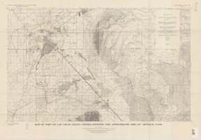
Map of part of Las Vegas Valley, Nevada, showing the approximate area of artesian flow, 1965
Image
View
Map of the Las Vegas ground-water basin, Clark, Nye, and Lincoln Counties, Nevada, 1965
Image
View
Map showing chemical diagrams representing quality of water in Clark and Nye counties, Nevada, 1963
Image
View
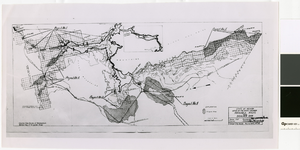
Map of irrigable areas near Boulder Dam, February 20, 1935
Image
View
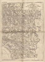
General map showing approximate location of better known springs and wells in the Mohave and adjacent deserts, southeastern California and southwestern Nevada, circa 1908-1909
Image
View