Search Results


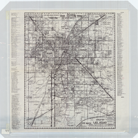
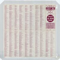
Street map of greater Las Vegas, Nevada, 1965-1966
Date
1965 to 1966
Description
Rev. 1965-1966 ed. 55 x 42 cm., folded to 29 x 12 cm. Panel title: Front Boy's official street map. Relief shown by spot heights. Copyright held by Russell A. Meador. Includes notes, quotations and indexes. Street index on verso. "Detailed guide of North Las Vegas, Las Vegas, Paradise Valley, and vicinity." Original publisher: Meador, Russell A.
Image
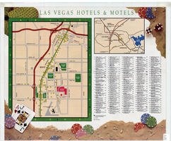
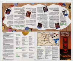
Map of Las Vegas hotels & motels, June 1990
Date
1990-06
Description
Color; 33 x 27 cm. on sheet 46 x 55 cm., folded to 23 x 10 cm. Panel title: Las Vegas area map. Shows locations of hotel and motels in the area of the Strip and Downtown. Also shows locations of country clubs. Includes a separate map of locations of hotels and motels in the surrounding area including North Las Vegas. Includes index. "LVM-75M-6/90."--Verso. Map of locations of golf courses on the verso along with information on points of interest, attractions, general information, tennis, bowling, recreational vehicle parks, and golf.
Image

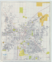
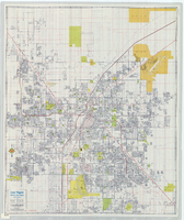
Street map of Las Vegas, North Las Vegas and vicinity, circa 1979
Date
1979
Description
Color; 88 x 73 cm., folded to 24 x 10 cm. "C6-87." Panel title: Las Vegas. Also shows Nellis Air Force Base. Indexes on verso. "Cartographic Department copyright 1979 by California State Automobile Association." Original publisher: California State Automobile Association. Cartographic Department. Scale: One kilometer = 5/8 mile
Image
Street map of Las Vegas, North Las Vegas and vicinty, circa 1979, front
Description
Scale: One kilometer = 5/8 mile
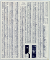
Street map of Las Vegas, North Las Vegas and vicinty, circa 1979, back
Description
Scale: One kilometer = 5/8 mile