Skip to main content
Main navigation
Finding Aids
Digital Projects
African American Experience in Las Vegas
Charles Saladino Landscape Architecture Collection
Culinary Union Photograph Collection
Dino at the Sands
Dreaming the Skyline
Entertainment
Historic Landscape of Nevada
Hoover Dam
Jamey Stillings
Menus: The Art of Dining
Nevada Test Site Oral History Project
Newspapers
Oral Histories Collection
Photograph Collections
Rebel Yell Newspaper
Showgirls
Southern Nevada: The Boomtown Years 1900-1925
Southern Nevada History in Maps
Southern Nevada Jewish Heritage Project
UNLV CSUN Records
Union Pacific Railroad Water Documents
Walking Box Ranch Collection
Welcome Home Howard
About
Request Images
Help
Provide Feedback
Special Collections Home
Search the Special Collections and Archives Portal
Search
Search
Breadcrumb
Special Collections and Archives Portal
Search Results
Display
List
Grid
Results Per Page
10
25
50
100
250
wheeler
Southern Nevada and Las Vegas, History in Maps
Displaying results 11 - 17 of 17
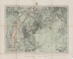
Map of economic features, part of central New Mexico, May 7, 1877
Image
View
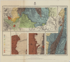
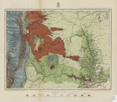
Map of Utah territory representing the extent of the irrigable, timber and pasture lands, 1878
Image
View
Map of part of North Central New Mexico atlas sheets 69(B), 69(D), 77(B) and 78(A), June 30, 1881
Image
View
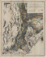
Map of parts of southern Colorado and northern New Mexico, atlas sheet no. 70(A), 1877
Image
View
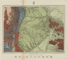
Map of part of north central New Mexico, atlas sheet no. 70(C), May 7th, 1877
Image
View
Map of part of central Colorado, May 7, 1877
Image
View
Map of part of south western Colorado, January 10, 1878
Image
View
Pagination
First page
« First
Previous page
‹ Previous
Page
1
Current page
2
Go
Refine my results
Content Type
Digital Object (17)
Creator or Contributor
Geographical Surveys West of the 100th Meridian (U.S.) (11)
Wheeler, George M. (George Montague), 1842-1905 (7)
Lockwood, D. W. (Daniel Wright) (3)
Stevenson, John J. (John James), 1841-1924 (3)
Hamel, P. W. (2)
United States. Army. Corps of Engineers (2)
Bien, Julius, 1826-1909 (1)
Geographical and Geological Survey of the Rocky Mountain Region (U.S.) (1)
Geological Survey (U.S.) (1)
Gilbert, Grove Karl, 1843-1918 (1)
Howell, Edwin E. (Edwin Eugene), 1845-1911 (1)
Humphries, A. A. (1)
Lyle, D. A. (David Alexander), 1845-1937 (1)
Mahon, Charles (1)
Marvine, A. R. (Archibald Robertson), 1848-1876 (1)
Nell, Louis (1)
New York Lithographing, Engraving and Printing Co. (1)
Powell, John Wesley, 1834-1902 (1)
Spurr, Josiah Edward, 1870-1950 (1)
United States. Army. Corps of Topographical Engineers (1)
United States. War Department (1)
Wheeler, H. C. (1)
Subject
Colorado (7)
Nevada (7)
New Mexico (6)
Geology (4)
Land capability for agriculture (4)
Discoveries in geography (3)
Land use (3)
Utah (3)
Arizona (2)
Southwest, New (2)
Arden, Nevada (1)
California (1)
Mojave Desert (1)
Surveying (1)
Telegraph lines (1)
United States--San Juan Mountains (1)
Water-pipes (1)
Water-supply (1)
Archival Collection
Chester R. Longwell Professional Papers (1)
Union Pacific Railroad Photographs (1)
Digital Project
Southern Nevada and Las Vegas, History in Maps (17)
African American Experience in Las Vegas (5)
Historic Landscape of Nevada (4)
The Historic Landscape of Nevada: Development, Water and Natural Environment (4)
Menus: The Art of Dining (3)
Nevada Test Site Oral History Project (3)
Southern Nevada The Boomtown Years 1900-1925 (3)
UNLV CSUN Minutes (2)
Southern Nevada Jewish Heritage Project (1)
Resource Type
Still Image (17)
Year
We are sorry, but this facet only works with JavaScript enabled. Please check your browser's settings.
Material Type
maps (documents) (17)
Place
Colorado (6)
Nevada (6)
New Mexico (6)
California (3)
Utah (2)
Arden (1)
Arizona (1)
Language
English (10)