Search the Special Collections and Archives Portal
Search Results
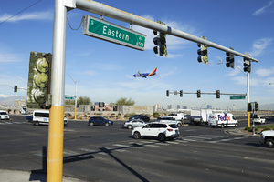
A Southwest Airline plane lands at McCarran International Airport as traffic navigates the intersection of Sunset Road and Eastern Avenue, looking west-northwest in Las Vegas, Nevada: digital photograph
Date
Archival Collection
Description
From the UNLV University Libraries Photographs of the Development of the Las Vegas Valley, Nevada (PH-00394). Part of the collection documents the entire 19 mile length of the north/south Eastern Avenue / Civic Center Drive alignment. This photograph was captured in the section of Eastern Avenue between Sunset and Warm Springs Roads.
Image
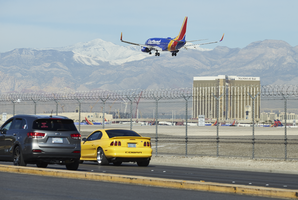
A Southwest Airline plane lands at McCarran International Airport as traffic flows down Sunset Road near Eastern Avenue, looking west in Las Vegas, Nevada: digital photograph
Date
Archival Collection
Description
From the UNLV University Libraries Photographs of the Development of the Las Vegas Valley, Nevada (PH-00394). Part of the collection documents the entire 19 mile length of the north/south Eastern Avenue / Civic Center Drive alignment. This photograph was captured in the section of Eastern Avenue between Sunset and Warm Springs Roads.
Image
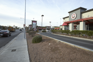
A Panda Express fast food store in a commercial shopping center on Eastern Avenue near East Karen Avenue, looking south-southwest in Las Vegas, Nevada: digital photograph
Date
Archival Collection
Description
From the UNLV University Libraries Photographs of the Development of the Las Vegas Valley, Nevada (PH-00394). Part of the collection documents the entire 19 mile length of the north/south Eastern Avenue / Civic Center Drive alignment. This photograph was captured in the section of Eastern Avenue between Sahara Avenue and Desert Inn Road.
Image
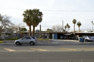
A single family residential neighborhood lines the south side of Vegas Valley Drive just off Eastern Avenue, looking south-southwest in Las Vegas, Nevada: digital photograph
Date
Archival Collection
Description
From the UNLV University Libraries Photographs of the Development of the Las Vegas Valley, Nevada (PH-00394). Part of the collection documents the entire 19 mile length of the north/south Eastern Avenue / Civic Center Drive alignment. This photograph was captured in the section of Eastern Avenue between Sahara Avenue and Desert Inn Road.
Image
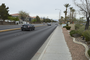
Cars travel down Serene Avenue, which is flanked by multi-family and commercial development, near Eastern Avenue, looking west-southwest in Las Vegas, Nevada: digital photograph
Date
Archival Collection
Description
From the UNLV University Libraries Photographs of the Development of the Las Vegas Valley, Nevada (PH-00394). Part of the collection documents the entire 19 mile length of the north/south Eastern Avenue / Civic Center Drive alignment. This photograph was captured in the section of Eastern Avenue between Pebble Road and Silverado Ranch Boulevard.
Image
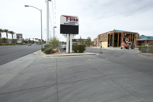
The old T-Bird lounge being converted to a Sierra Gold pub off Eastern Avenue south of Serene Avenue, looking south-southwest in Las Vegas, Nevada: digital photograph
Date
Archival Collection
Description
From the UNLV University Libraries Photographs of the Development of the Las Vegas Valley, Nevada (PH-00394). Part of the collection documents the entire 19 mile length of the north/south Eastern Avenue / Civic Center Drive alignment. This photograph was captured in the section of Eastern Avenue between Pebble Road and Silverado Ranch Boulevard.
Image
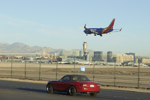
A Southwest Airlines plane lands at McCarran International Airport as a car travels on Sunset Road near Eastern Avenue, looking west-northwest in Las Vegas, Nevada: digital photograph
Date
Archival Collection
Description
From the UNLV University Libraries Photographs of the Development of the Las Vegas Valley, Nevada (PH-00394). Part of the collection documents the entire 19 mile length of the north/south Eastern Avenue / Civic Center Drive alignment. This photograph was captured in the section of Eastern Avenue between Sunset and Warm Springs Roads.
Image
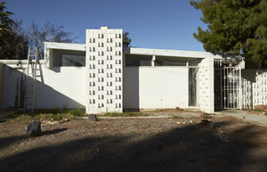
Exterior view of a mid-century modern single family home on Pueblo Way undergoing renovation in the Paradise Palms neighborhood, looking southwest in Las Vegas, Nevada: digital photograph
Date
Archival Collection
Description
From the UNLV University Libraries Photographs of the Development of the Las Vegas Valley, Nevada (PH-00394). Part of the collection documents the entire 19 mile length of the north/south Eastern Avenue / Civic Center Drive alignment. This photograph was captured in the section of Eastern Avenue between Desert Inn and Flamingo Roads.
Image
Messages, left as part of the 1 October memorial, cover a light fixture at the Welcome to Las Vegas sign, looking south-southwest in Las Vegas, Nevada: digital photograph, 2017 October 18
Level of Description
Archival Collection
Collection Name: UNLV University Libraries Photographs of the Response to the 1 October Shooting in Las Vegas, Nevada
Box/Folder: Digital File 00
Archival Component
Late afternoon sunshine lights up the water feature at the Las Vegas Community Healing Garden, looking west-southwest in Las Vegas, Nevada: digital photograph, 2019 April 07
Level of Description
Archival Collection
Collection Name: UNLV University Libraries Photographs of the Response to the 1 October Shooting in Las Vegas, Nevada
Box/Folder: Digital File 00
Archival Component
