Search the Special Collections and Archives Portal
Search Results
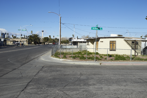
Single family homes on Oakey Boulevard at Ardmore Street near Eastern Avenue, looking west-southwest in Las Vegas, Nevada: digital photograph
Date
Archival Collection
Description
From the UNLV University Libraries Photographs of the Development of the Las Vegas Valley, Nevada (PH-00394). Part of the collection documents the entire 19 mile length of the north/south Eastern Avenue / Civic Center Drive alignment. This photograph was captured in the section of Eastern Avenue between Charleston Boulevard and Sahara Avenue.
Image
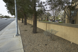
Multi-family housing off Eastern Avenue north of Silverado Ranch Boulevard, looking south-southwest in Las Vegas, Nevada: digital photograph
Date
Archival Collection
Description
From the UNLV University Libraries Photographs of the Development of the Las Vegas Valley, Nevada (PH-00394). Part of the collection documents the entire 19 mile length of the north/south Eastern Avenue / Civic Center Drive alignment. This photograph was captured in the section of Eastern Avenue between Pebble Road and Silverado Ranch Boulevard.
Image
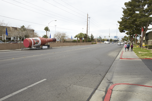
A liquor bottle mobile ad sits on East Karen Avenue near Eastern Avenue, looking southwest in Las Vegas, Nevada: digital photograph
Date
Archival Collection
Description
From the UNLV University Libraries Photographs of the Development of the Las Vegas Valley, Nevada (PH-00394). Part of the collection documents the entire 19 mile length of the north/south Eastern Avenue / Civic Center Drive alignment. This photograph was captured in the section of Eastern Avenue between Sahara Avenue and Desert Inn Road.
Image
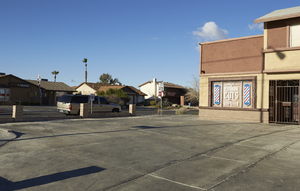
A single family home converted into a live and work space on Eastern Avenue at Rawhide Street, looking southwest in Las Vegas, Nevada: digital photograph
Date
Archival Collection
Description
From the UNLV University Libraries Photographs of the Development of the Las Vegas Valley, Nevada (PH-00394). Part of the collection documents the entire 19 mile length of the north/south Eastern Avenue / Civic Center Drive alignment. This photograph was captured in the section of Eastern Avenue between Tropicana Avenue and Russell Road.
Image
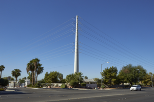
Power pole turns away from East Sahara Avenue west of Tree Line Drive, looking southwest, Las Vegas, Nevada: digital photograph
Date
Archival Collection
Description
Image
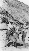
Don Finley and Jack Parsons obtaining water for Josiah Irving Crowell's mine at Chloride Cliff in the Funeral Mountains southwest of Beatty, Nevada: photographic print
Date
Archival Collection
Description
From the Nye County, Nevada Photograph Collection (PH-00221) -- Series III. Beatty, Nevada -- Subseries III.D. Crowell Family. Water is being taken from a well in a canyon east of Chloride Cliff.
Image
Standard Operating Procedures Quality Assurance/Quality Control Manual for NPDES and POTW Discharge Permittees by Converse Enviromental Consultans Southwest, Inc, 1992 February
Level of Description
Archival Collection
Collection Name: Clark County Planning Commission Research Library Collection
Box/Folder: Box 03
Archival Component
Custom home and commercial neighbors north of West Sahara Avenue and west of Buffalo Road, looking southwest, Las Vegas, Nevada, 2017 October 11
Level of Description
Archival Collection
Collection Name: UNLV University Libraries Photographs of the Development of the Las Vegas Valley, Nevada
Box/Folder: N/A
Archival Component
Aerial view, southwest, of (left) cell building No. 1, (right) cell building No. 2, and temporary brick finishing building in background: photographic print, 1942 January 13
Level of Description
Archival Collection
Collection Name: Basic Magnesium, Inc. (BMI) Records and Photographs
Box/Folder: Box 04
Archival Component
Aerial view, southwest, showing construction progress preparation plant (left) and crushed magnesite storage silos (right): photographic print, 1942 February 17
Level of Description
Archival Collection
Collection Name: Basic Magnesium, Inc. (BMI) Records and Photographs
Box/Folder: Box 03
Archival Component
