Search the Special Collections and Archives Portal
Search Results

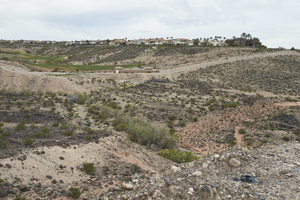
Undeveloped land below custom homes and the Rio Secco Golf Club as seen from Pecos Ridge Parkway west of Eastern Avenue, looking south-southwest in Henderson, Nevada: digital photograph
Date
Archival Collection
Description
From the UNLV University Libraries Photographs of the Development of the Las Vegas Valley, Nevada (PH-00394). Part of the collection documents the entire 19 mile length of the north/south Eastern Avenue / Civic Center Drive alignment. This photograph was captured in the section of Eastern Avenue between Sunridge Heights Parkway and Grand Hills Drive.
Image

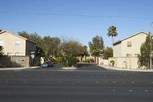
Single family homes flank the entrance to the Villa Sedona development across from the Palm Eastern Mortuary and Cemetery on Eastern Avenue, looking west-southwest in Las Vegas, Nevada: digital photograph
Date
Archival Collection
Description
From the UNLV University Libraries Photographs of the Development of the Las Vegas Valley, Nevada (PH-00394). Part of the collection documents the entire 19 mile length of the north/south Eastern Avenue / Civic Center Drive alignment. This photograph was captured in the section of Eastern Avenue between Warm Springs Road and Windmill Parkway.
Image

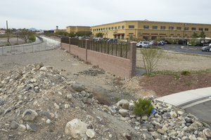
The Pittman Pecos Conveyance and the Cactus-Wren Trail wind around a commercial development and an undeveloped parcel on Candelaria Street off Eastern Avenue, looking south-southwest in Henderson, Nevada: digital photograph
Date
Archival Collection
Description
From the UNLV University Libraries Photographs of the Development of the Las Vegas Valley, Nevada (PH-00394). Part of the collection documents the entire 19 mile length of the north/south Eastern Avenue / Civic Center Drive alignment. This photograph was captured in the section of Eastern Avenue between Pebble Road and Silverado Ranch Boulevard.
Image

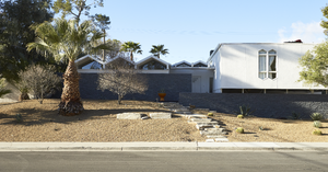
Exterior view of a mid-century modern single family home on Pueblo Way in the Paradise Palms neighborhood near Eastern Avenue, looking south-southwest in Las Vegas, Nevada: digital photograph
Date
Archival Collection
Description
From the UNLV University Libraries Photographs of the Development of the Las Vegas Valley, Nevada (PH-00394). Part of the collection documents the entire 19 mile length of the north/south Eastern Avenue / Civic Center Drive alignment. This photograph was captured in the section of Eastern Avenue between Desert Inn and Flamingo Roads.
Image
The Vegas Strong F-15C Eagle on display at the 2017 Aviation Nation Nellis Air and Space Expo, looking west-southwest at Nellis Air Force Base in Nevada: digital photograph, 2017 November 11
Level of Description
Archival Collection
Collection Name: UNLV University Libraries Photographs of the Response to the 1 October Shooting in Las Vegas, Nevada
Box/Folder: Digital File 00
Archival Component
#68466: Jackie Thompson, Community Affairs and Grassroots Manager for Southwest Airlines at a ticket counter in McCarran International Airport for a Foundation Global Gaming Business ad on February 13, 2012, 2012 February 13
Level of Description
Archival Collection
Collection Name: University of Nevada, Las Vegas Creative Services Records (2010s)
Box/Folder: Digital File 00
Archival Component
Mid-century modern inspired block wall design in disrepair off Desert Inn Road near Eastern Avenue, looking west-southwest in Las Vegas, Nevada: digital photograph, 2019 March 07
Level of Description
Archival Collection
Collection Name: UNLV University Libraries Photographs of the Development of the Las Vegas Valley, Nevada
Box/Folder: N/A
Archival Component
Undeveloped land inside the McCarran Marketplace as seen from Russell Road near Eastern Avenue with a Lowes Home Improvement store, looking southwest in Las Vegas, Nevada: digital photograph, 2019 March 14
Level of Description
Archival Collection
Collection Name: UNLV University Libraries Photographs of the Development of the Las Vegas Valley, Nevada
Box/Folder: N/A
Archival Component
Traffic flows on Eastern Avenue next to the McCarran International Airport fence as seen from Eastern Avenue and Patrick Lane, looking south-southwest in Las Vegas, Nevada: digital photograph, 2019 March 14
Level of Description
Archival Collection
Collection Name: UNLV University Libraries Photographs of the Development of the Las Vegas Valley, Nevada
Box/Folder: N/A
Archival Component
Lennar Development's Aventine neighborhood under construction as seen from Pecos Ridge Parkway west of Eastern Avenue with custom homes above, looking southwest in Henderson, Nevada: digital photograph, 2019 April 02
Level of Description
Archival Collection
Collection Name: UNLV University Libraries Photographs of the Development of the Las Vegas Valley, Nevada
Box/Folder: N/A
Archival Component
