Search the Special Collections and Archives Portal
Search Results
Union Pacific Railroad supporting infrastructure and facilities: contains architectural and structural drawings of warehouses in Overton, California, 1930 December 24
Level of Description
Archival Collection
Collection Name: Union Pacific Railroad Collection
Box/Folder: Flat File 191
Archival Component

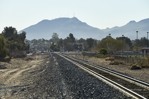
Railroad tracks lead towards Black Mountain off Eastern Avenue north of Warm Springs Road, looking east-southeast in Las Vegas, Nevada: digital photograph
Date
Archival Collection
Description
From the UNLV University Libraries Photographs of the Development of the Las Vegas Valley, Nevada (PH-00394). Part of the collection documents the entire 19 mile length of the north/south Eastern Avenue / Civic Center Drive alignment. This photograph was captured in the section of Eastern Avenue between Sunset and Warm Springs Roads.
Image

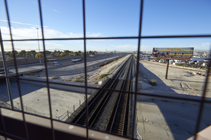
Looking south-southeast from the pedestrian bridge where I-15, the railroad tracks, and the Las Vegas Wash meet in North Las Vegas, Nevada: digital photograph
Date
Archival Collection
Description
From the UNLV University Libraries Photographs of the Development of the Las Vegas Valley, Nevada (PH-00394). Part of the collection documents the entire 19 mile length of the north/south Eastern Avenue / Civic Center Drive alignment. This photograph was captured in the section of Civic Center Drive between Alexander Road and Cheyenne Avenue.
Image

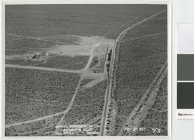
Aerial photograph showing railroad siding and water storage tanks, Basic Magnesium Inc., Henderson, Nevada, October 8, 1941
Date
Archival Collection
Description
Aerial view looking east that shows the temporary rail siding and water storage tanks south of the Basic Magnesium Inc. site.
Transcribed Notes: Transcribed from front of photo: "McNeil construction Co. Magnesium plant, Las Vegas, Nevada, 10-8-41"
Image
Union Pacific Railroad supporting infrastructure and facilities: contains architectural and civil drawings of office buildings and site infrastructure in Las Vegas, Nevada, preliminary sketches, map of wells and water lines, and a map of the Las Vegas Union Pacific Railroad system, 1944 July 15-1955 January 01
Level of Description
Archival Collection
Collection Name: Union Pacific Railroad Collection
Box/Folder: Flat File 167
Archival Component

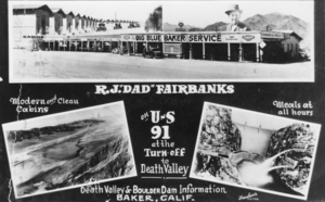
Composite: Baker, California service station on the west Side of the Tonopah and Tidewater Railroad track; Death Valley; Hoover Dam, Nevada: photographic print
Date
Archival Collection
Description
From the Nye County, Nevada Photograph Collection (PH-00221) -- Series VII. Other areas in Nye County -- Subseries VII.F. Lowe Family. The top photo, a composite, was taken about 1928, when R.J. "Dad" Fairbanks first moved to Baker and established a service station on the west Side of the Tonopah and Tidewater Railroad tracks. Photo on the bottom left Shows Death Valley; on the right is a photo of Hoover Dam.
Image
Union Plaza Hotel and Fremont Street; view looks east from where the Union Pacific Railroad depot used to be, undated
Level of Description
Archival Collection
Collection Name: Wayne Cronister Photograph Collection
Box/Folder: Folder 01
Archival Component
Locomotive no. 3649 of SP, LA, & SL (San Pedro, Las Vegas, and Salt Lake) Railroad in Las Vegas, Nevada, 1912
Level of Description
Archival Collection
Collection Name: David Coons Photograph Collection
Box/Folder: Folder 01
Archival Component
Tecopa Railroad #1 2-6-2T BLW 1909 #34089 at Noonday Mine, near Tecopa, California: photographic print, approximately 1900 to 1932
Level of Description
Archival Collection
Collection Name: Mallory H. Ferrell Photograph Collection
Box/Folder: Folder 01
Archival Component
Union Pacific Railroad: contains architectural and structural drawings for railroad bridges along the Union Pacific Los Angeles Division. Includes drawings showing runoff water flow near Las Vegas, Nevada and the bridges over the Mojave River in San Bernardino, California, 1917 December-1952 July 31
Level of Description
Archival Collection
Collection Name: Union Pacific Railroad Collection
Box/Folder: Flat File 203
Archival Component
