Search Results
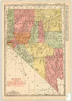

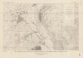
Map of part of Las Vegas Valley, Nevada, showing the approximate area of artesian flow, 1965
Date
1965
Description
At top of map: 'United States Department of the Interior, Geological Survey. Water supply paper 1780, plate 2.' At bottom of map: 'Base from U.S. Geological Survey Las Vegas (1952) and Henderson (1952) quadrangles.' 'Interior--Geological Survey, Washigton, D.C.--1965--W63358.' Relief shown by contours. Includes township and range lines. Thematic map. Scale 1:62,500 (W 115°15´--W 114°45´/N 36°15´--N 36°00´). Series: Water-supply paper (Washington, D.C.)1780. Originally published as plate 2 of Available water supply of the Las Vegas ground-water basin, Nevada, by Glenn T. Malmberg, published by the Geological Survey in 1965 as its Water-supply paper 1780.
Image
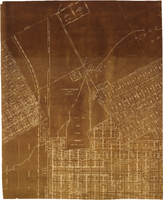
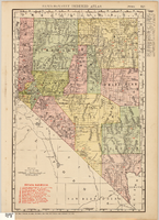
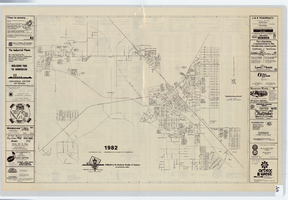
Map of major subdivisions near downtown Las Vegas, Nevada, circa 1931
Date
1928 to 1935
Archival Collection
Description
Map shows deed number and date of deed for some public properties and location and composition of water pipelines. '1-2-31' handwritten in upper right corner. Cadastral maps. Plat map with sepia tone..
Image