Search Results
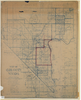
Map of Clark County, Nevada, 1927
Date
Description
Image
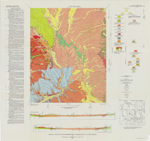
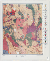
Geologic map of the Buckboard Mesa quadrangle, Nye County, Nevada, 1966
Date
Description
Image
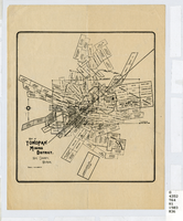
Map of Tonopah Mining District, Nye County, Nevada, circa 1903
Date
Description
Image
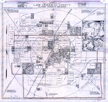
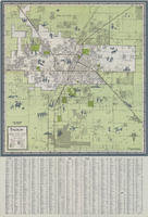
Map of the city of Las Vegas and vicinity, Clark County, Nevada, 1929
Date
Description
Image
Geologic reconnaissance map of portions of southwestern Nevada and eastern California, 1905
Date
Description
Image
Map of Las Vegas and vicinity, 1963
Date
Description
Image
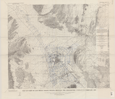
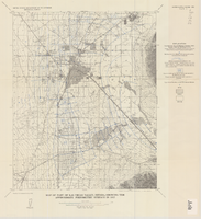
Map of part of Las Vegas Valley, Nevada, showing the piezometric surface in February 1955
Date
Description
Relief shown by contours. Includes township and range lines. Scale 1:96,000 (W 115°30´--W 114°45´/N 36°30´--N 36°00´). Series: Water-supply paper (Washington, D.C.)
1780. Originally published as plate 3 of Available water supply of the Las Vegas ground-water basin, Nevada, by Glenn T. Malmberg, published by the Geological Survey in 1965 as its Water-supply paper 1780.
Image
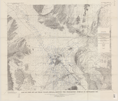
Map of part of Las Vegas Valley, Nevada, showing the piezometric surface in September 1955
Date
Description
Relief shown by contours. Includes township and range lines. Scale 1:96,000 (W 115°30´--W 114°45´/N 36°30´--N 36°00´). Series: Water-supply paper (Washington, D.C.)
1780. Originally published as plate 4 of Available water supply of the Las Vegas ground-water basin, Nevada, by Glenn T. Malmberg, published by the Geological Survey in 1965 as its Water-supply paper 1780.
Image
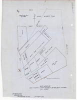
Plat showing cultivated land in the Stewart Ranch, Las Vegas, Nevada, December 8, 1902
Date
Archival Collection
Description
Image
Map of part of Las Vegas Valley, Nevada, showing the approximate piezometric surface in 1912
Date
Description
Image