Search Results
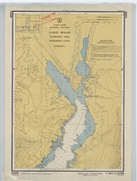
Hydrographic map of Lake Mead, Overton Arm, Southern and Northern Parts, back
Description
Scale: 1:48,000
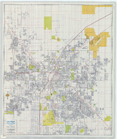
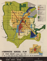
Street map of Las Vegas, North Las Vegas and vicinty, circa 1979, front
Description
Scale: One kilometer = 5/8 mile
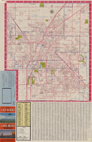
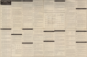
Street map of Las Vegas, North Las Vegas and vicinty, circa 1979, back
Description
Scale: One kilometer = 5/8 mile


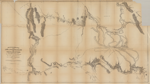
Map based on reconnaissance of the Zuñi, Little Colorado and Colorado Rivers in 1851 by U.S. Corps of Topographical Engineers
Date
1852
Description
Transcribed from the original: 'Made in 1851 under the direction of Col J.J. Abert, Chief of Corps Topographical Engineers, by BVT. Capt. L. Sitgreaves, T.E., assisted by Lieut. J.G. Parke, T.E., and Mr. M.H. Kern. Drawn by R.H. Kern, 1852.' 'Gila River from a reconnaissance by Maj. Emory, Topographical Engrs. Colorado River below Camp Yuma from a reconnaissance by Lt. Derby Topographical Engrs.' Shows Indian villages and forts. Upper right corner partially missing. Scale [ca. 1:650,000]. Scale of 10 miles to one inch.' 'Ackerman Lith.: 379 Broadway, N.Y.'
Image