
Search the Special Collections and Archives Portal

Search Results

Display    Results Per Page
Displaying results 141 - 150 of 523882

Map showing profile of 24-inch cast iron water pipeline for Las Vegas, Nevada, May 20, 1930

Date

1930-05-20

Description

'As constructed. Drawing W.O. - 8577. Office of Chief Engineer, Los Angeles. Drawing No. 41092.' 'Scale for details 1"=10'. 5-20-1930. P.F.D.' 'Scale 1"=100'.' 'Profile of new 24" CI pipe. Scale 1"=600'. Ver. 1"=20'.' Blueprint. Map of the water pipes for Las Vegas. Includes the buildings in the railroad yard, a detailed map of a section of the pipe, a profile of the 24 inch C.I. pipe, and a map of the point of diversion. Date of detailed map is 5-20-1930. Library's copy has hand-written additions in color. Los Angeles & Salt Lake Railroad Co., Office of Chief Engineer,

Image

Map of Boulder Dam area and Las Vegas, Nevada, October 7, 1930

Date

1930-10-07

Description

'F.V. Owen, publisher ... Los Angeles, California. Topography by C.H. Fenner, C.E. Decorations by L.J. Bergère. Gov't. data, H.A. Shamberger, C.E. Copyright, 1930, by F.V. Owen.' At bottom right of map: 'Dated Oct. 7th, 1930.' Relief shown by contours and spot heights. Contour lines are 100 feet. Incudes six hand-colored illustrations showing local points of interest. Includes information on Hoover Dam, and chart of mileages from Las Vegas. Scale [ca. 1:63,360]. 1 inch to 1 mile

Text

Map showing configuration of potentiometric surfaces in Paleozoic and Cenozoic aquifers in the area between the Las Vegas Valley and the Amargosa Desert, Nevada, 1963

Date

1963

Description

'Department of the Interior, United States Geological Survey. TEI-840.' 'Prepared in cooperation with the U.S. Atomic Energy Commission.' 'Contours in northwest Las Vegas Valley from Malmberg, 1961.' Relief shown by contours. Shows township and range lines. Scale [ca. 1:253,440. 1 in.=aprrox. 4 miles] (W 114°00´--W 115°00´--N 37°00´/N 36°00´). Originally published in A summary of the ground-water hydrology of the area between the Las Vegas Valley and the Amargosa Desert, Nevada : with special reference to the effects of possible new withdrawals of ground water / by Isaac J. Winograd, published by the U.S. Geological Survey in 1963 as number 840 of the Trace elements investigations report.

Image

Map showing proposed new 12" well and pipe line changes at Water Springs, Las Vegas, Nevada, circa 1920

Date

1916 to 1925

Description

In lower right corner: '6-W-74.' Scale: 1" = 500'.

Image

Blueprint map showing proposed new 12" well and pipe line changes at water springs, Las Vegas, Nevada, circa 1920

Date

1916 to 1925

Description

Stamped : 'Approved (Signed) A. Maguire, Assistant Chief Engineer.' In lower right corner: '6-W-74.' Some annotations written over in yellow; black dotted line added between forebay and final spring in the northwest. Scale [ca. 1:6,000] 1 in.=500 feet

Image

Map of Lincoln County, Nevada and Mohave County, Arizona area, 1892

Date

1892

Description

'Henry Gannett, chief geographer ; A.H. Thompson, geographer in charge ; triangulation by H.M. Wilson ; topography by H.M. Wilson and Powell survey.' 'Edition of Mar. 1892, reprinted 1929.' Handwritten legend on right-side margin of map. Original publisher: Dept. of the Interior, U.S. Geological Survey. Scale 1:250,000polyconic proj. (W 115°--W 114°/N 37°--N 35°).

Image

Jewish Nevada Records

Identifier

MS-00602

Abstract

The Jewish Nevada Records document the organization's philanthropic activities in Las Vegas, Nevada from 1978 to 2018. The majority of the collection represents the organization's activities under the name the Jewish Federation of Las Vegas. The collection includes administrative files, annual reports, marketing materials, donation records, video recordings of interviews and events, and audio recordings of board meetings. The collection also includes photographic prints and negatives of events hosted by Jewish Nevada.

Archival Collection

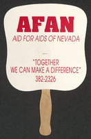
Aid for AIDS of Nevada fan

Date

1990 (year approximate) to 1999 (year approximate)

Description

From the Dennis McBride Collection on LGBTQ Las Vegas, Nevada (MS-00802) -- Alphabetical research files -- AIDS: Organizations: Aid for AIDS of Nevada (AFAN) file.

Text

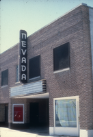
Slide of the Nevada Theater, Wells, Nevada, 1986

Date

1986

Description

An image of the Nevada Theater located in Wells. The black and white neon sign located above the entrance doors to the building reads: "Nevada." Site Name: Nevada Theater (Wells, Nev.)

Image

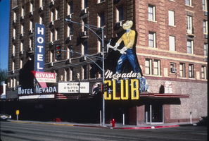
Slide of Nevada Club, Ely, Nevada, 1986

Date

1986

Description

An image of the exterior of the Nevada Club and Hotel Nevada in Ely. Mounted onto the brick building and hanging over the club's entrance is a large sign of a miner with a pickaxe. Various neon signs read: "Welcome, 21 Slots & Food, Dancing;" "Hotel Nevada;" "Free Parking;" and "Nevada Club."

Image