Search the Special Collections and Archives Portal
Search Results
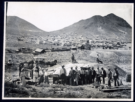
Photograph of group of people posing at Montana Tonopah Mine, Tonopah (Nev.), 1902
Date
Archival Collection
Description
Image
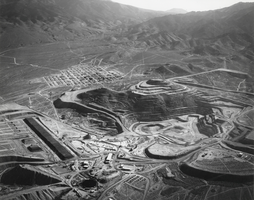
Aerial view of the Round Mountain Gold Company's mining operation in Nevada: photographic print
Date
Archival Collection
Description
From the Nye County, Nevada Photograph Collection (PH-00221) -- Series V. Smoky Valley, Nevada and Round Mountain, Nevada -- Subseries V.C. Lofthouse-Berg Families (Round Mountain). The community of Round Mountain is visible in the upper left center. The remains of Stebbins Peak can be seen on the left and Round Mountain on the right. The pit operation is visible in front of Round Mountain and Stebbins peaks. The heap leaching pads are visible as a dark wide line to the lower left of center. Looking east, Jefferson Canyon is visible in the upper center part of the pictures.
Image
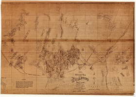
New official map of the Bullfrog Mining District, Nye County (Nev.), 1905
Date
Description
Image
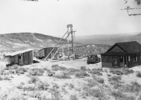
Headframe and buildings at the Gold Bar Mine, Nevada: photographic print
Date
Archival Collection
Description
From the Nye County, Nevada Photograph Collection (PH-00221) -- Series III. Beatty, Nevada -- Subseries III.G. Reidhead Family. The pickup belongs to Beatty resident Fred Davies.
Image

Photograph of the Southwestern Mining Company's Quartz Mill along the river, Eldorado Canyon (Nev.), 1900-1925
Date
Description
Caption: Southwestern Mining Co. Quartz Mill.
Site Name: Southwestern Mining Company Quartz Mill (Clark County, Nev.)
Image

Photograph of workers piling sacks of ore from the Jumbo Mine, Goldfield (Nev.), early 1900s
Archival Collection
Description
Image

