Search the Special Collections and Archives Portal
Search Results
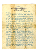
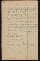
Letter from C. A. Earle Rinker to his father, April 27, 1908
Date
1908-04-27
Archival Collection
Description
Letter to his father. He addressed gold panning, Easter Sunday church in Goldfield being packed, and work in the mines.
Text
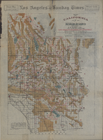
Map of California and Nevada deserts, 1905
Date
1905
Description
'Compiled by G.E. Bailey, E.M. Issued under the auspices of the the Los Angeles Chamber of Commerce and the supervision of its mining committee, Dan Murphy, H.Z. Osborne, Geo. W. Parsons, F.W. Braun, O.P. Posey, 1905.' 'A carefully prepared and authentic map of the desert mining region tributary of Los Angeles, embracing portions of Lincoln, Nye and Esmeralda counties, Nevada, showing location of all water supplies.' At top of page: 'Desert map. California-Nevada'. 'Miner's guide. Springs and waterholes.' Relief shown by hachures. Shows range and township grid. Scale indeterminable (W 119°--W 114°/N 37°--N 33°).
Image

Miner's dugout along Gold Road: photographic print
Date
1992
Archival Collection
Description
Miner's dugout in Gold Road, 8 miles east of Oatman, Arizona (a silver mine). Photo taken in 1992.
Image

Topographic map of groundwater in the southeast quadrangle of Las Vegas, Nevada, 1980
Date
1980
Description
'Las Vegas Area Map 3Af.' 'Prepared in cooperation with U.S. Geological Survey.' 'Water Resources Division, U.S. Geological Survey, Carson City, Nevada.' 'Topographic base from U.S. Geological Survey, Las Vegas SE 7 1/2 quadrangle, 1967.' Scale 1:24,000 (W 115°07'30"--W 115°00'00"/N 36°07'30"--N 36°00'00"). Series: Las vegas area map ; 3Af. Urban area maps. Las Vegas area map ; 3Af. Relief shown by contour lines and spot heights. Title in margins of map: Las Vegas SE quad. : ground water. Title on publications list on Nevada Bureau of Mines and Geology website: Groundwater map of the Las Vegas SE quadrangle. Series: Urban area maps [Las Vegas area map] from publications list on Nevada Bureau of Mines and Geology website. Nevada Bureau of Mines and Geology
Text
Pagination
Refine my results
Content Type
Creator or Contributor
Subject
Archival Collection
Digital Project
Resource Type
Year
Material Type
Place
Language
Records Classification


