Search the Special Collections and Archives Portal
Search Results

Map of approved mineral surveys in the Goldfield Mining District, Goldfield (Nev.), 1908
Date
1908
Description
Scale [ca. 1:9,600]. 1 in. to 800 feet. (W 117 14'--W 117 09'/N 37 46'--N 37 41') ; 1 map ; 129 x 97 cm ; Blueline print ; Includes township and range grid ; "Copyright 1908 by Davis and Byler. 1911." ; Library's copy has upper-left corner torn off and has circles drawn around and diagonal lines drawn on certain claims ;
Image
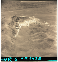
Film negatives of aerial views of a strip mining operation in the Las Vegas region, August 21, 1956
Date
1956-08-21
Description
Series of two black and white negative aerial views of a strip mining operation in the Las Vegas region, dated August 21, 1956.
Image
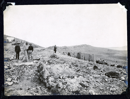
Photograph of men loading ore at Sandstorm Mine, Esmeralda (Nev.), early 1900s
Archival Collection
Description
Caption: Sandstorm Loading Ore
Image
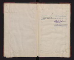
Communication and legal documents about the court case Robert Martin vs. Cottonwood Canyon Mines Company about a workplace mining shaft injury, 1913
Level of Description
File
Archival Collection
Hugh H. Brown Papers
To request this item in person:
Collection Number: MS-00883
Collection Name: Hugh H. Brown Papers
Box/Folder: Box 01
Collection Name: Hugh H. Brown Papers
Box/Folder: Box 01
Archival Component
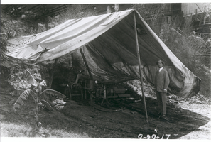
Photograph of Howard R. Hughes, Sr., with trench mining drill, Houston, Texas, September 29, 1917
Date
1917-09-29
Archival Collection
Description
Howard R. Hughes, Sr., standing outdoors by a trench mining drill, which is underneath a tent-like canopy. Part of the Sharps-Hughes Tool Company's Second and Girard Streets plant is seen in the background.
Image
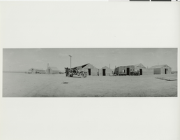
Photograph of a group of men and an automobile at a mining camp, Hornsilver or Lida, Nevada, 1915
Date
1915
Archival Collection
Description
A parked automobile and a group of men sit outside of tents and an unfinished building in Hornsilver or Lida mining camp.
Image
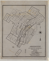
Map of Argentite: Red Mountain Mining District, Esmeralda County (Nev.),1908
Date
1908
Description
Scale [ca. 1:7,200]. 1 in. equals 600 feet ; 1 map : linen ; 46 x 39 cm
Image
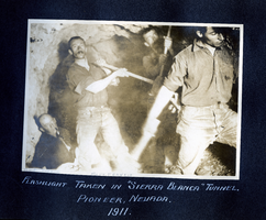
Photograph of miners working inside the Sierra Blanca Mine tunnel, Pioneer (Nev.), 1911
Date
1911
Archival Collection
Description
Annotated: Bert Turner [bottom left] and Matt. Francis [bottom center]
Caption: Flashlight taken in Sierra Blanca Tunnel. Pioneer, Nevada. 1911.
Caption: Flashlight taken in Sierra Blanca Tunnel. Pioneer, Nevada. 1911.
Image

Photograph of men working at the Red Top Mine, Goldfield (Nev.), early 1900s
Archival Collection
Description
Caption: The new strike on the red top. Goldfield
Image
Pagination
Refine my results
Content Type
Creator or Contributor
Subject
Archival Collection
Digital Project
Resource Type
Year
Material Type
Place
Language
Records Classification

