Search the Special Collections and Archives Portal
Search Results
New Mexico
Level of Description
File
Archival Collection
UNLV University Libraries Menu Collection
To request this item in person:
Collection Number: MS-00436
Collection Name: UNLV University Libraries Menu Collection
Box/Folder: N/A
Collection Name: UNLV University Libraries Menu Collection
Box/Folder: N/A
Archival Component

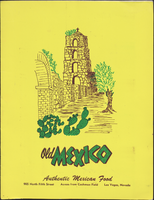
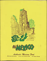
Old Mexico menu
Date
1950 (year approximate) to 1980 (year approximate)
Archival Collection
Description
Note: Front cover illustration has the initials "MF." in very small print. Menu is in Spanish and English with a "Spanish food dictionary" printed at the bottom Menu insert: Wine lists Restaurant: Old Mexico Location: 905 North 5th Street, Las Vegas, Nevada, United States
Text

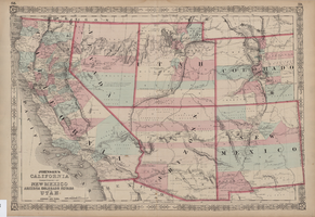
Map of California, territories of New Mexico, Arizona, Colorado, Nevada and Utah, circa 1863
Date
1861 to 1865
Description
40 x 62 cm. Relief shown by hachures and spot heights. Prime meridians: Greenwich and Washington. "Historical and statistical view of the United States, 1860"--Verso. Atlas page numbers at top: 58-59. Arizona became a territory in 1863, and Nevada became a state on October 31, 1864, so this map was either published in 1863 or in 1864 before the end of October. Original publisher: Johnson and Ward.
Image
1968 Summer Olympics in Mexico City, Mexico administrative files, 1968
Level of Description
File
Archival Collection
Gerald Schaffer Professional Papers
To request this item in person:
Collection Number: MS-01065
Collection Name: Gerald Schaffer Professional Papers
Box/Folder: Box 01
Collection Name: Gerald Schaffer Professional Papers
Box/Folder: Box 01
Archival Component
1968 Summer Olympics in Mexico City, Mexico: photographic prints, 1968
Level of Description
File
Archival Collection
Gerald Schaffer Professional Papers
To request this item in person:
Collection Number: MS-01065
Collection Name: Gerald Schaffer Professional Papers
Box/Folder: Box 01
Collection Name: Gerald Schaffer Professional Papers
Box/Folder: Box 01
Archival Component
Correspondence,, Mexico, 1984
Level of Description
File
Archival Collection
Desert Fishes Council Records
To request this item in person:
Collection Number: MS-00572
Collection Name: Desert Fishes Council Records
Box/Folder: Box 06
Collection Name: Desert Fishes Council Records
Box/Folder: Box 06
Archival Component
Marriage: Mexico, 2016
Level of Description
File
Archival Collection
Dennis McBride Collection on LGBTQ Las Vegas, Nevada
To request this item in person:
Collection Number: MS-00802
Collection Name: Dennis McBride Collection on LGBTQ Las Vegas, Nevada
Box/Folder: Box 26
Collection Name: Dennis McBride Collection on LGBTQ Las Vegas, Nevada
Box/Folder: Box 26
Archival Component
Mexico Trips, 1990s
Level of Description
File
Archival Collection
Culinary Workers Union Local 226 Las Vegas, Nevada Photographs
To request this item in person:
Collection Number: PH-00382
Collection Name: Culinary Workers Union Local 226 Las Vegas, Nevada Photographs
Box/Folder: Box 26
Collection Name: Culinary Workers Union Local 226 Las Vegas, Nevada Photographs
Box/Folder: Box 26
Archival Component

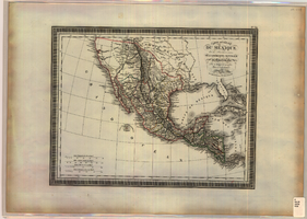
Map of Mexico and Central America, 1826
Date
1826
Description
'Par L. Vivien, Géographe, Gravée par Giraldon-Bovinet. 1826, Paris. Chez Ménard & Desenne, Rue Git-le-Coeur, No. 8.' Scale [ca. 1:15,840,000] (W 125°--W 75°/N 35°--N 05°). Relief shown by hachures. Hand colored. Atlas plate number in upper margin: no. 34. Ménard & Desenne
Image
Pagination
Refine my results
Content Type
Creator or Contributor
Subject
Archival Collection
Digital Project
Resource Type
Year
Material Type
Place
Language
Records Classification

