Search Results
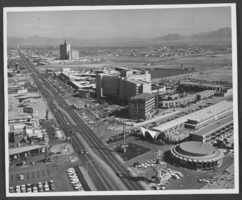
Photograph of hotels on Las Vegas Boulevard, Las Vegas, Nevada, circa 1966
Date
1965 to 1967
Archival Collection
Description
Partial view of the Las Vegas Strip looking northeast from north of Desert Inn Road in Las Vegas, Nevada. The El Rancho Vegas, Riviera, La Concha, and El Morocco Motel are visible on the right side of the photograph. The Westward Ho, Denny's Restaurant, and Satellite Motel are visible on the left. The Sahara Hotel is seen in the distance.
Image
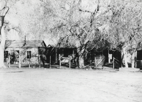
Photograph of Las Vegas Ranch, Las Vegas, circa 1900-1926
Date
1900 to 1926
Archival Collection
Description
The view of homes at the Las Vegas Ranch in Las Vegas, Nevada. Site Name: Las Vegas Ranch (Las Vegas, Nev.)
Image
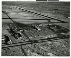
Photograph of Las Vegas Airport, Las Vegas (Nev.), 1960s
Date
1960 to 1969
Archival Collection
Description
Aerial view of the Las Vegas McCarran Airport.
Image
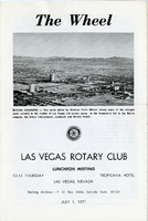
The Wheel Las Vegas Rotary Club newsletter, June 3, 1982
Date
1982-06-03
Archival Collection
Description
Newsletter issued by the Las Vegas Rotary Club
Text
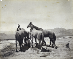
Photograph of Las Vegas Ranch, Las Vegas, circa 1900-1910
Date
1900 to 1907
1008
1909 to 1910
Archival Collection
Description
An unidentified man with horses on the Las Vegas Ranch in Las Vegas, Nevada. Site Name: Las Vegas Ranch (Las Vegas, Nev.)
Image
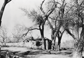
Photograph of the Las Vegas Ranch, Las Vegas, circa early 1900s
Date
1900 to 1950
Archival Collection
Description
The Las Vegas Ranch house and south wall of the Las Vegas Fort. Site Name: Las Vegas Ranch (Las Vegas, Nev.)
Image
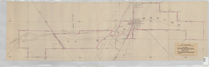
Map showing contemplated improvements to develop the Las Vegas Ranch at Las Vegas, Nevada
Date
1926-03-09
Description
Shows springs, Clark's Las Vegas Townsite, Buck's Addition, cemetery, and State Experimental Farm. Shows township and range lines. From the Union Pacific Collection. Written on the map: "Union Pacific System, Los Angeles & Salt Lake Railroad Co., Map showing contemplated improvements to develop the Las Vegas Ranch at Las Vegas, Nev. Scale 1" - 800" Dwg. No. 31171. Office of Asst. Chief Engr., L.A.&S.L.R.R. Los Angeles, Calif., March 9, 1926. Approved: "
Image
The Wheel Las Vegas Rotary Club newsletter, July 1, 1971
Date
1971-07-01
Archival Collection
Description
Newsletter issued by the Las Vegas Rotary Club
Text
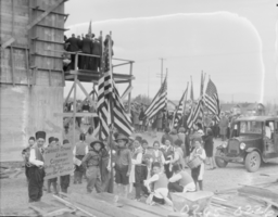
Film transparency of Las Vegas High School, Las Vegas, February 22, 1930
Date
1930-02-22
Archival Collection
Description
Unidentified children carrying flags and signs at the cornerstone-laying ceremony for the new Las Vegas High School in Las Vegas, Nevada.
Image
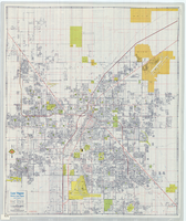
Street map of Las Vegas, North Las Vegas and vicinity, circa 1979
Date
1979
Description
Color; 88 x 73 cm., folded to 24 x 10 cm. "C6-87." Panel title: Las Vegas. Also shows Nellis Air Force Base. Indexes on verso. "Cartographic Department copyright 1979 by California State Automobile Association." Original publisher: California State Automobile Association. Cartographic Department. Scale: One kilometer = 5/8 mile
Image