Search the Special Collections and Archives Portal

Search Results
Display    Results Per Page
Displaying results 3851 - 3860 of 4493

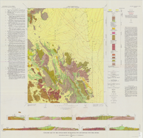
Geologic map of the Jangle Ridge quadrangle, Nye and Lincoln Counties, Nevada, 1965

Date

1965

Description

58 x 46 cm., on sheet 84 x 87 cm., folded in envelope 30 x 24 cm. Relief shown by contours and spot heights. "Contour interval 20 feet." "Prepared in cooperation with the U.S. Atomic Energy Commission." "Geology mapped in 1961. Limit of pluvial Groom Lake and faults from photographs mapped by R. B. Colton, 1962." Includes text, bibliography, location map, and 5 col. cross sections. Original publisher: Interior, U.S. Geological Survey, Series: Geologic quadrangle map GQ, Scale: 1:24 000.

Image

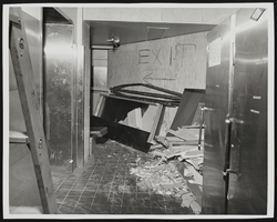
Photograph of construction debris for Stardust renovation, Las Vegas, (Nev.), March 18, 1975

Date

1975-03-18

Description

Scene of interior renovation at Stardust Hotel. Debris litters the floor, and the word "Exit" with a left-pointing arrow has been written on a wooden board. A sign taped to the left metal doors reads "Notice All Personnel Must Use Room Service Or Casino Exits At All Times By Order Of Board Of Health Security Dept." This black and white photograph was taken during the renovation period of the hotel and casino. Site Name: Stardust Resort and Casino Street Address: 3000 South Las Vegas Boulevard

Image

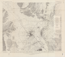
Map of part of Las Vegas Valley, Nevada, showing changes in the land-surface altitude, 1935-50

Date

1965

Description

Genre/Form: Topographic maps. Scale 1:96,000 (W 115°30´--W 114°45´/N 36°30´--N 36°00´). 1 map ; 58 x 70 cm. Series: Water-supply paper (Washington, D.C.) ; 1780. Relief shown by contours. "After Smith, Vetter, Cummings, and others (1960, p. 34)." Originally published as plate 13 of Available water supply of the Las Vegas ground-water basin, Nevada, by Glenn T. Malmberg, published by the Geological Survey in 1965 as its Water-supply paper 1780. Includes township and range lines. Interior, Geological Survey

Image

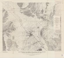
Map of part of Las Vegas Valley, Nevada, showing changes in the land-surface altitude, 1935 to 1940-41

Date

1965

Description

Genre/Form: Topographic map. Scale 1:96,000 (W 115°30´--W 114°45´/N 36°30´--N 36°00´). 1 map ; 58 x 70 cm. Series: Water-supply paper (Washington, D.C.) ; 1780. Relief shown by contours. "After C.R. Longwell (written communication, 1954, fig. 30)." Originally published as plate 12 of Available water supply of the Las Vegas ground-water basin, Nevada, by Glenn T. Malmberg, published by the Geological Survey in 1965 as its Water-supply paper 1780. Includes township and range lines. Interior, Geological Survey

Image

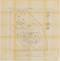
Map showing estimated average recharge to and discharge from ground-water reservoirs by basins, and hydraulic potential in Clark and Nye counties, Nevada, 1963

Date

1963

Description

'T.E. Eakin, S.L. Schoff, and P. Cohen, 1963.' 'Department of the Interior, United States Geological Survey, TEI-833.' 'Prepared in cooperation with the U.S. Atomic Energy Commission.' Scale 1:500,000 (W 117°30´--W 115°00´/N 38°30´--N 36°30´). Originally published as figure 2 in Regional hydrology of a part of southern Nevada : a reconnaissance / by Thomas E. Eakin, Stuart L. Schoff, and Philip Cohen, published by the U.S. Geological Survey in 1963 as number 833 of the Trace elements investigation report.

Image

Transcript of interview with Brad Friedmutter by David G. Schwartz, September 12, 2016

Date

2016-09-12

Description

Brad Friedmutter is the architect behind a number of Steve Wynn’s prominent casinos in Las Vegas, Nevada and Atlantic City, New Jersey. He obtained his degree in architecture in 1973 from the Cooper Union School of Architecture in lower Manhattan and worked on a number of smaller projects before connecting with Steve Wynn. After meeting the famous Vegas tycoon, Friedmutter built a number of well-known casinos, like the Golden Nugget and the Mirage. In this interview, he discusses the development of his numerous projects, explains his process for starting and completing architectural projects, and the future of urban planning and casino design.

Text
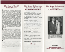
Jean Weinberger Museum of Jewish Culture pamphlet, 1996

Date

1996

Archival Collection

Description

A pamphlet for the Jean Weinberger Museum, presented by The Foundation of the Jewish Federation of Las Vegas.

Text
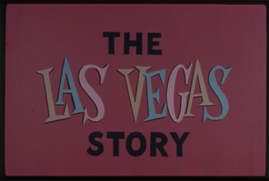
Glass slides of Las Vegas hotels and aerial views of Clark County (Nev.), 1950s-1960s (tray 1 of 3)

Date

1950 to 1969

Description

Slides collected by the Culinary Workers Union Local 226 depict Las Vegas and Clark County during the 1950s and the 1960s. Individual photographs show the Strip, downtown Las Vegas, Boulder City, Lake Mead, the Hoover Dam, and individual hotels (including the Flamingo, Tropicana, El Rancho, Dunes, Sahara, Desert Inn, Stardust, Landmark, Thunderbird, Sands, Tallyho, Riviera, Golden Nugget, Mint, Binion's Horsehoe, Pioneer Club, Fremont, and Four Queens). Aerial shots and photographs of buildings under construction, marquees, and interiors are included. There are also photos of showgirls and the Las Vegas Convention Center. Tray 1 of 3. The original slides were retained by the Union.Arrangement note: Series V. Glass slides

Image
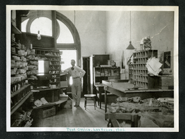
Photograph of Walter Bracken inside the post office, Las Vegas (Nev.), 1908

Date

1908

Description

Walter Bracken stands inside the Las Vegas Post Office, which had been moved to the interior of the First State Bank on Fremont Street in 1907. Bracken served as Las Vegas' postmaster from 1904-1914. Pigeon holes containing sorted mail surround the room. Desks, stools and office equipment, including a postage scale, are seen. Calendars hang from the wall and electric lights hang from the ceiling.
Caption: Post Office, Las Vegas, 1908
Site Name: United States Post Office and Court House

Image