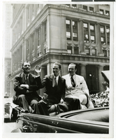
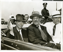
Search Results
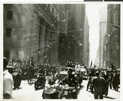
Photograph of a parade procession for Howard Hughes, New York, July 15, 1938
Date
1938-07-15
Archival Collection
Description
Photograph of Grover Whalen, Howard Hughes, and Al Lodwick during a parade procession for the completion of Hughes' Round-the-World flight.
Image
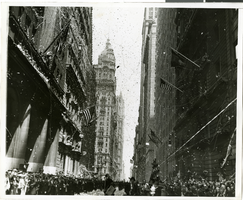
Photograph of a parade procession for Howard Hughes, New York, July 15, 1938
Date
1938-07-15
Archival Collection
Description
A picture of the crowd at a parade celebrating the completion of Howard Hughes' round the world flight. Typed onto a piece of paper attached to the image: "Parade - 7/15/38."
Image
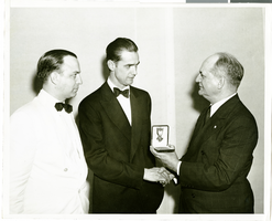
Photograph of Howard Hughes and Col. Moss, New York, July 20, 1938
Date
1938-07-20
Archival Collection
Description
Handwritten on the back of the image: "Col. Moss, Pres-Gen. of U. S. Flag Association, presenting Cross of Honor at World's Fair dinner. 7/20/38."
Image
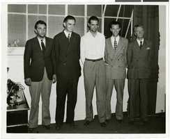
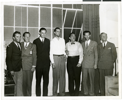
Photograph of Howard Hughes and other men, New York, July 14, 1938
Date
1938-07-14
Archival Collection
Description
Description printed on photograph's accompanying sheet of paper: "Group at [Gover] Whalen's home 7/14/38. (Daily News)." Howard Hughes is standing third from the left.
Image

Photograph of Howard Hughes and other men, New York, July 14, 1938
Date
1938-07-14
Archival Collection
Description
Description printed on photograph's accompanying sheet of paper: "Group at [Gover] Whalen's home 7/14/38. (Daily News)." Howard Hughes is standing third from the left.
Image
Photograph of Howard Hughes and other men, New York, July 14, 1938
Date
1938-07-14
Archival Collection
Description
Description printed on photograph's accompanying sheet of paper: "Group at [Gover] Whalen's home 7/14/38. (Daily News)." Howard Hughes is standing fourth from the left.
Image
Photograph of a parade procession for Howard Hughes, New York, July 15, 1938
Date
1938-07-15
Archival Collection
Description
Photograph of Grover Whalen, Howard Hughes, and Al Lodwick during a parade procession for the completion of Hughes' Round-the-World flight.
Image
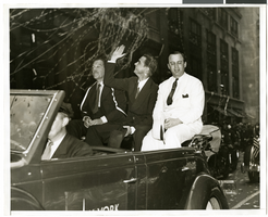
Photograph of a parade procession for Howard Hughes, New York, July 15, 1938
Date
1938-07-15
Archival Collection
Description
Picture of Grover Whalen, Howard Hughes, and Al Lodwick riding in the back of an automobile during a parade celebrating Howard Hughes' completion of his round-the-world flight.
Image
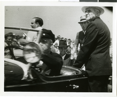
Photograph of Howard Hughes and crew at a parade, New York, July 15, 1938
Date
1938-07-15
Archival Collection
Description
The black and white view of Howard Hughes and his crew at a parade for Howard Hughes after he completed his Around The World flight in New York.
Image
Photograph of Howard Hughes and crew at a parade, New York, July 15, 1938
Date
1938-07-15
Archival Collection
Description
The black and white view of Howard Hughes and his crew at a parade for Howard Hughes after he completed his Around The World flight in New York.
Image